Damage Assessment Insights on Properties Impacted by Hurricane Ian
When a catastrophic event such as Hurricane Ian occurs, the scope and scale of destruction is almost unimaginable, leaving tens of thousands of people, communities, and businesses grappling with the aftermath. The path to recovery and restoration needs to begin as soon as possible, but the challenge of knowing where to start, who was impacted the most from the storm, and what needs to be done can cause lingering questions, especially for our insurer members. But now we have a new product that enables insurers to see at a glance the level of damage to a home, to a neighborhood, to a community, to the entire affected area.
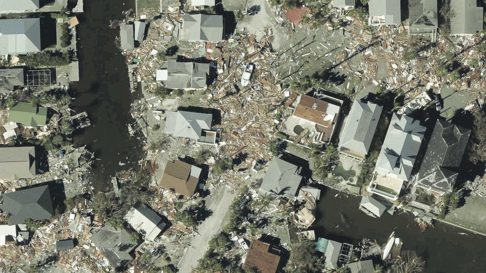
Damage Assessment uses machine learning (ML) to deliver automatically generated property insights in seconds. When applied against Hurricane Ian aerial imagery, our insurer members can quickly and more efficiently spot and identify damaged homes and buildings at a glance.
So how does Damage Assessment work and what are the pieces of information pulled from our Gray Sky imagery?
Useful & Immediate Insights
As insurers begin assessing damage in Florida across the multiple areas hit hard by Hurricane Ian, they want to know things such as:
- Which policies in force (PIFs) are impacted?
- What level of damage has a home or building sustained? Who do they need to get to first?
- How can remote assessment begin to save time and resources when responding to customers in need?
Being able to answer just these few questions can help insurers start off on the right foot after a major weather event. But going beyond imagery, finding actionable insights, is where Damage Assessment takes property and building reviews to the next level.
Starting with location coordinates, insurers can quickly view automated insights that provide trusted context for what exists on the ground. Damage is categorized in multiple ways on a building and includes:
- an overall CAT score (XX/100)
- an approximate FEMA rating (X/6 with 0 = no damage and 6 = completely destroyed)
- roof information: missing material, structure damage, and tarp covering roof
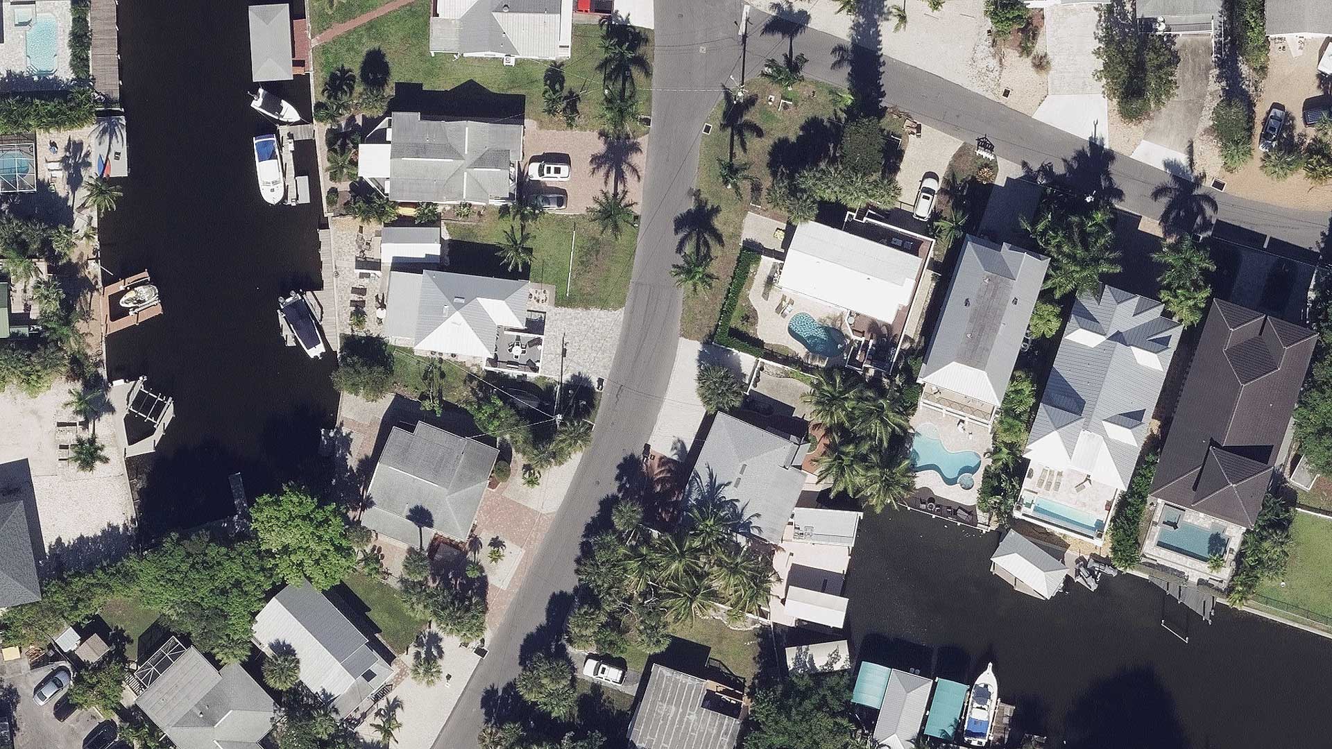
Compare Before and After Using Blue Sky Imagery
The next step in verifying change or damage is using the GIC’s comprehensive Blue Sky imagery to compare against Gray Sky imagery. This comparison can help insurers validate change on a property and reduce uncertainty when processing a claim. It also plays a large role in combatting fraudulent claims as imagery is timestamped to aid in claim validation.