Gray Sky Event: Hurricane Ian
- Read all about our initial collection and view a substantial gallery of imagery below.
- Learn how Damage Assessment can fundamentally transform how damaged properties are identified and improve the claims process.

On September 28, 2022, a little after 3 p.m., Hurricane Ian made landfall as a Category 4 storm with sustained winds of 150 mph, just short of being a Cat 5 event. It struck first on Cayo Costa, an island off the coast of Fort Myers and began its slow move inland. Over the next 24 hours, the storm would wreak havoc on multiple areas across southwest Florida, battering neighborhoods with high winds, rain, and massive storm surge. It was eventually downgraded to a Cat 1 storm but it’s 140 mile-wide destructive path had been laid.
Before Hurricane Ian had come close to making landfall, our Gray Sky team was activated, moving multiple planes from our fleet into position near Florida. It was clear from the growing intensity of the storm that this was no ordinary event and would cause massive damage not seen for many, many years. Due to the preparation prior to Hurricane Ian making landfall, our planes were able to get up in the air less than 24 hours after the storm began. The size of the hurricane’s path was a clear indication that imagery collection would be needed over several days. But the hardest hit areas–Cape Coral, Fort Myers, and other locations–needed to be collected asap to help deliver the true scope and scale of damage to our members and emergency managers.
How Gray Sky Imagery Helps Insurers and Emergency Managers
The flagship program for the GIC is Gray Sky, the longest running disaster collection program for catastrophic weather events such as hurricanes, tornadoes, and wildfires. The imagery collected after these events fundamentally changes how insurers and emergency managers can respond to those in need, especially when access on the ground is blocked or limited for days. Emergency managers are able to verify safe routes for providing assistance to those trapped in heavily impacted areas. Insurers can use GIC imagery and data analytics to automatically generate a quick damage assessment on their customers’ homes, allowing them to proactively reach out to and begin the claims process.
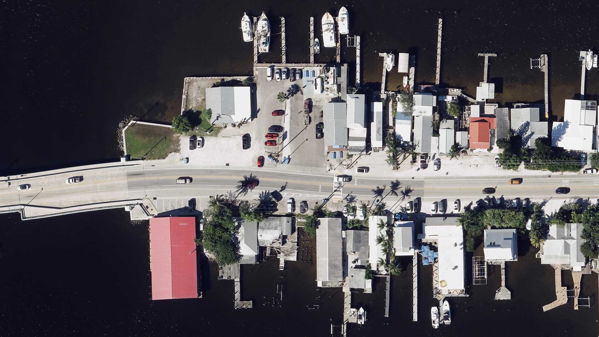
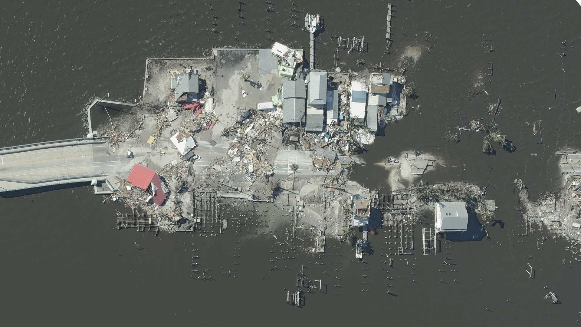
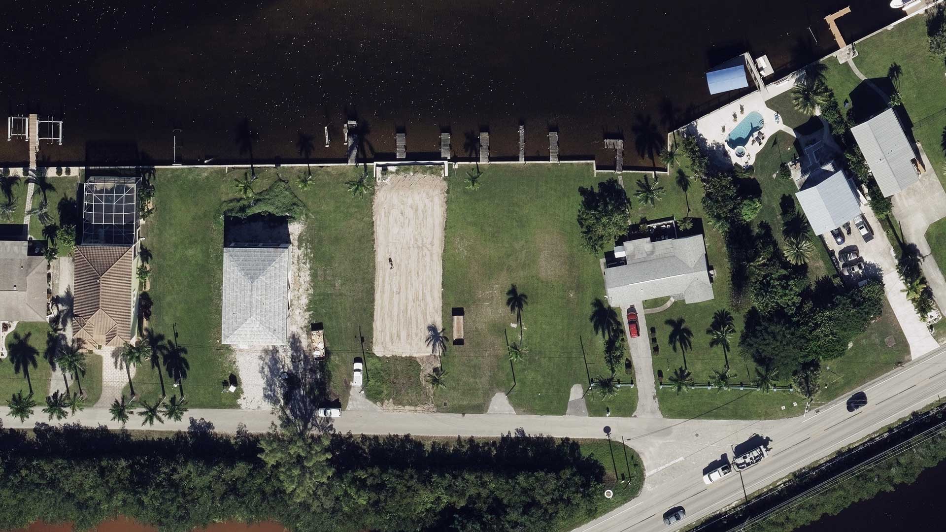
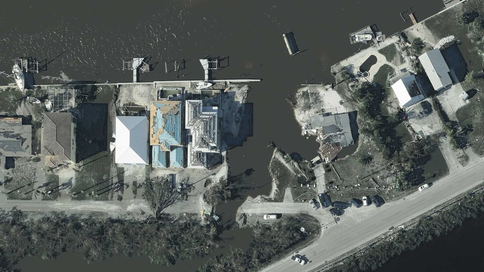
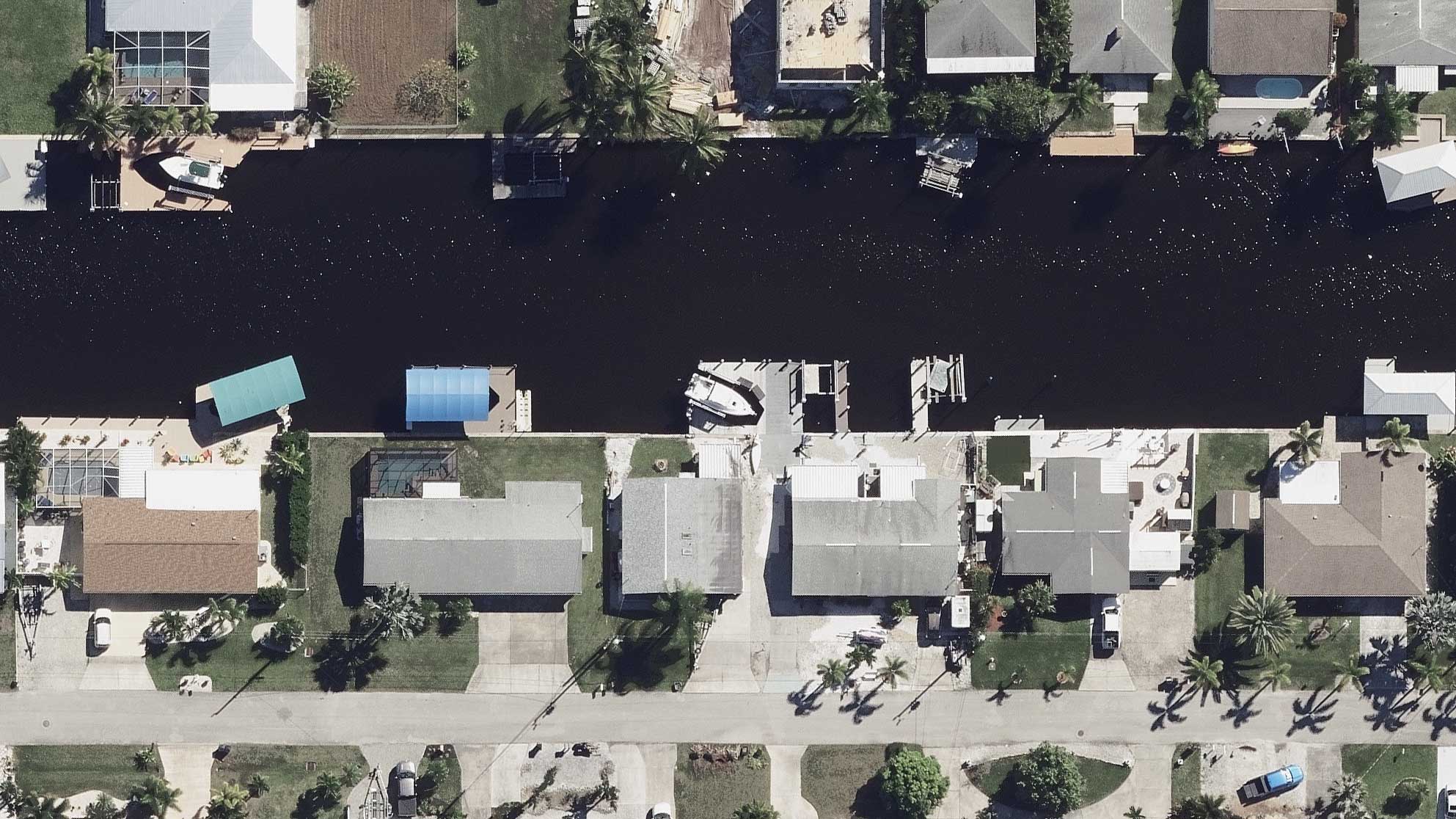
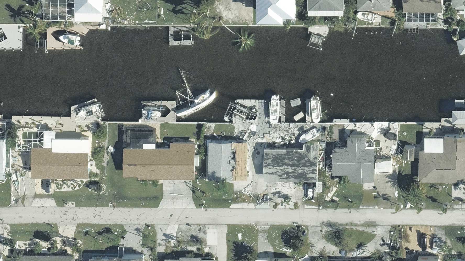
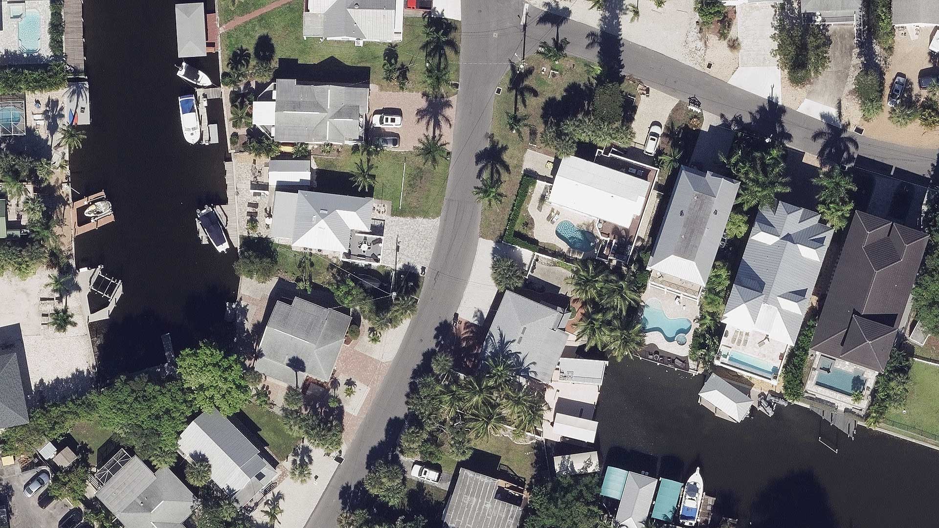
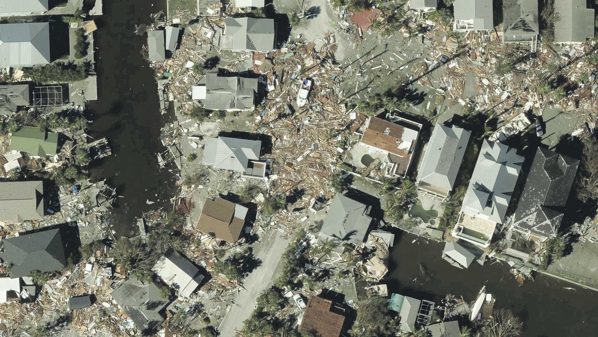
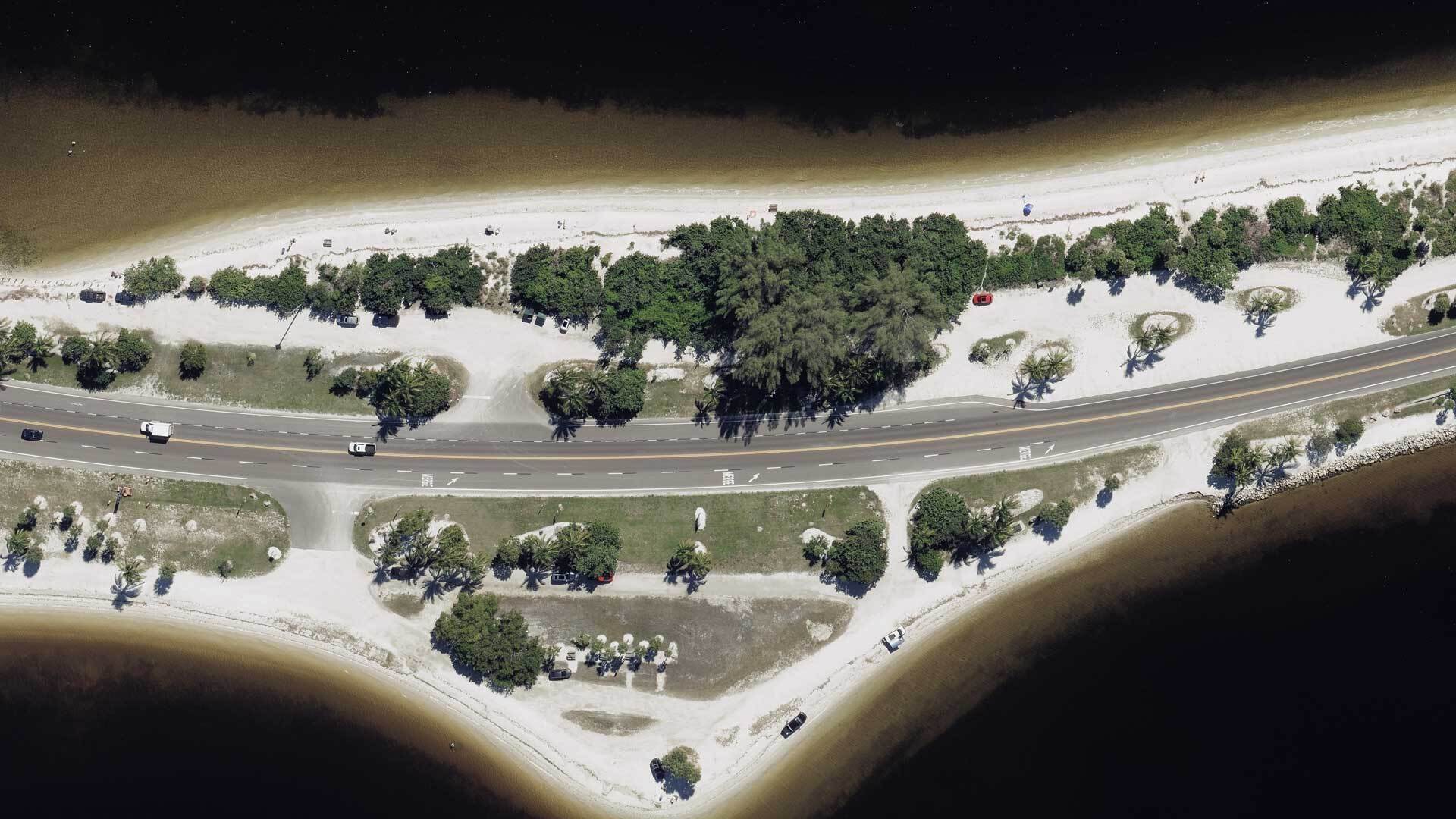
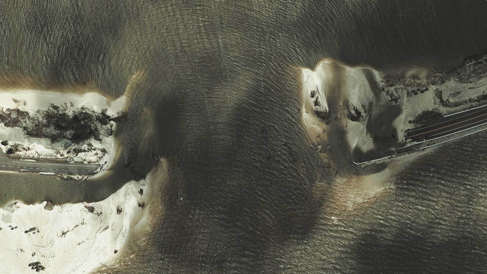
Gray Sky Gallery
Below are oblique and ortho images from our collections across multiple areas in Florida hit by Hurricane Ian. Since we anticipate our capture to occur over multiple days to fully reflect the vastness of this devastation, the gallery will continue to be updated as imagery is published to our platform, Viewer, and via GIC partner platforms such as Vexcel Image Services for ArcGIS.