Gray Sky Event: Maui, Hawaii Wildfires
High-Resolution Aerial Imagery and Damage Reports for Lahaina and Kula Areas


Catastrophic wildfires, fanned by high winds, have destroyed more than 1,500 residential homes and commercial buildings in the historic town of Lahaina in western Maui. The GIC team monitored the fires and collected feedback from GIC members. Then on Friday morning (Hawaii time), with lighter winds and less wildfire smoke obstructing damaged areas, the GIC went into full activation and collected high-resolution imagery over the impacted areas of Lahaina. The crew collected 12 square kilometers.
This is the GIC’s first Gray Sky event in Hawaii. This post-CAT collection provides high-resolution orthos at a 7.5cm resolution. This highly detailed imagery provides our GIC members and emergency managers the full scope of the fire damage to better understand the impact on the local community.
In addition, GIC members and partners noted their interest in other fires on Maui. The GIC activated again and collected additional areas over the weekend. Imagery for all collections are now available, covering Lahaina, Pulehu, Makawao, and Kula.


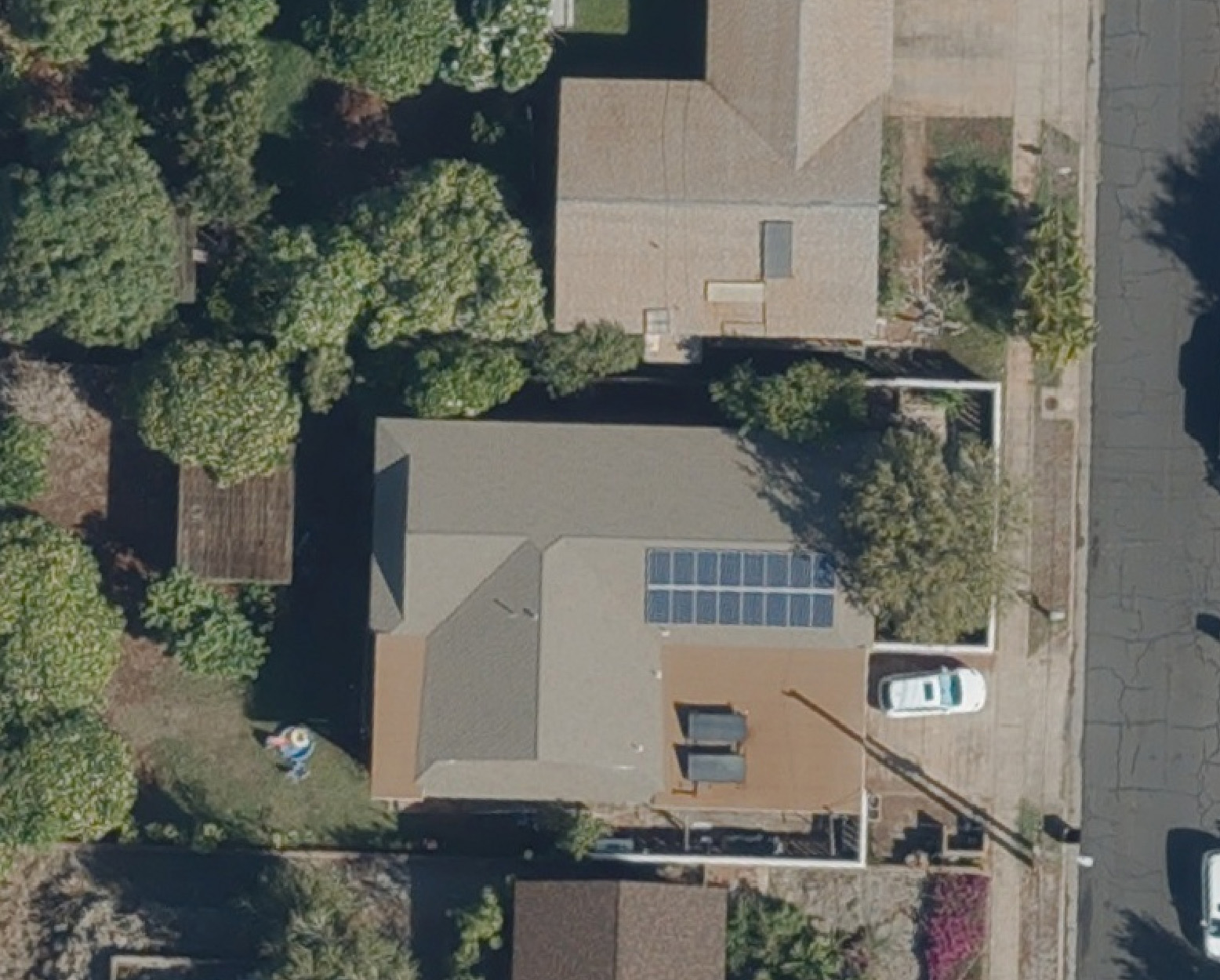
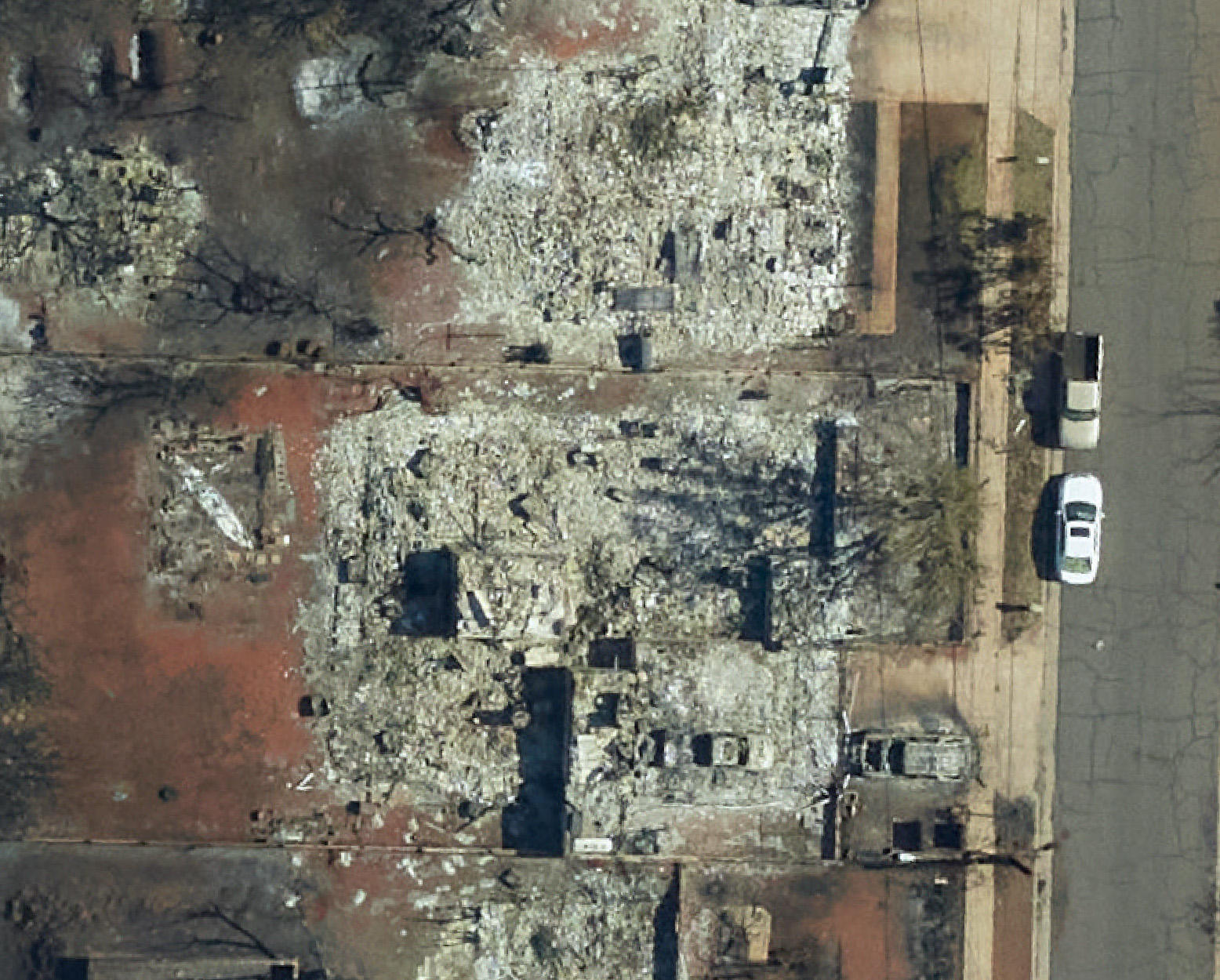
Before & After Imagery
The GIC’s operations partner, Vexcel, also provides images from a previous collection in Lahaina. View before and after images and get a small glimpse into the level of detail our Gray Sky program provides for its members, partners, and other agencies.