Gray Sky Event: Gray Fire in Medical Lake, Washington
High-resolution ortho and oblique imagery now available.


The Summary
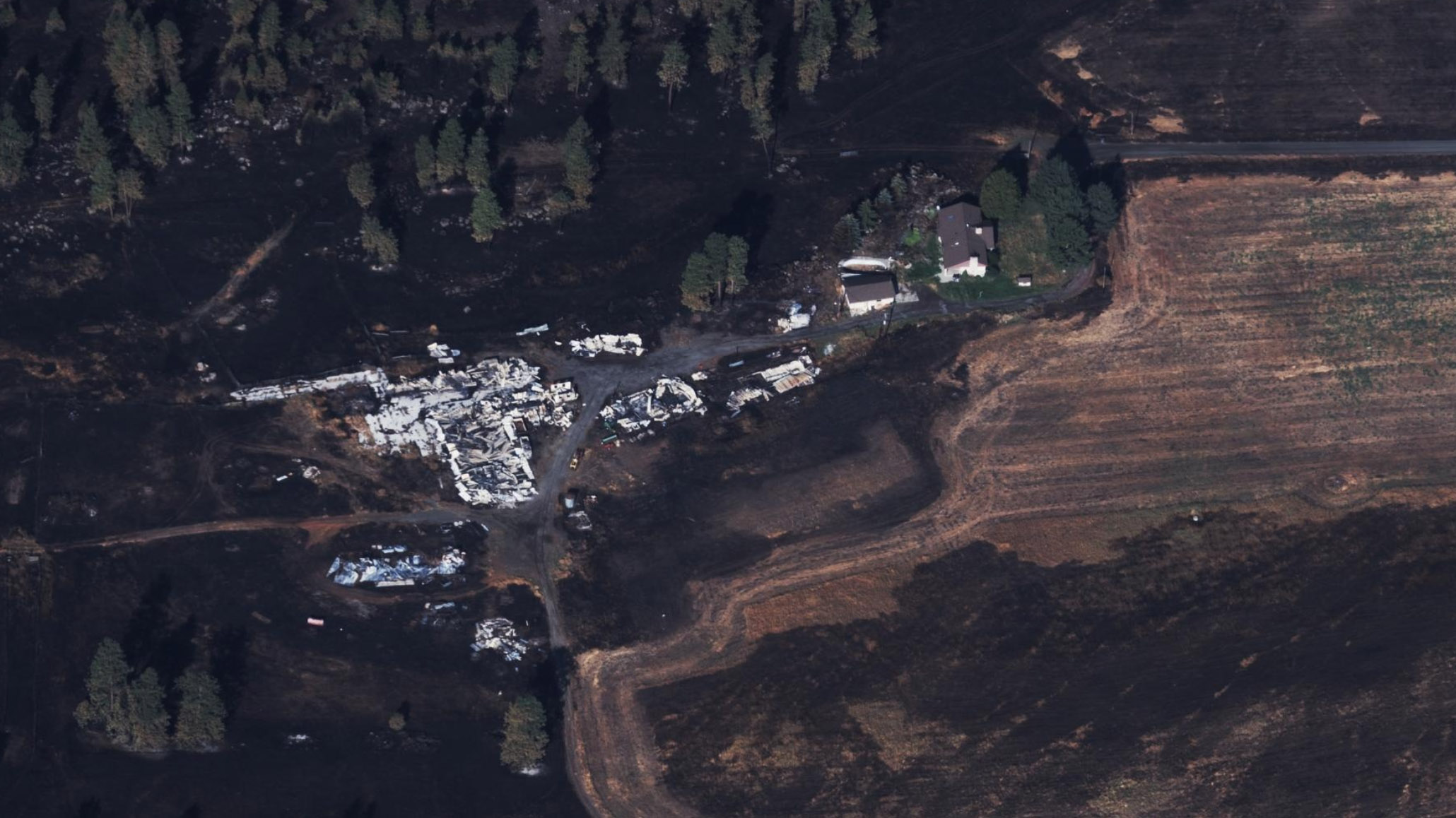
The Gray Fire was first spotted on Friday, August 18th and swift eastern winds quickly spread the flames to more than 10,000 acres in a few days. The GIC has monitored the fire’s impact since day one. And over the weekend several GIC insurer members said their customers were impacted, and requested Gray Sky imagery as soon as it was safe to fly. Once the smoke cleared and the residual storms from Hurricane Hilary blew past, the GIC went into full activation mode on Wednesday morning, August 23rd. The GIC, working with its operations partner Vexcel, collected high-resolution aerial imagery of the more than 150 properties in and around Medical Lake, Washington. The imagery collection covered roughly 100 km2 of the burn zone.
This collection includes 10cm orthos and obliques, providing our members and government agencies a multi-perspective view of the fire-damaged properties. The highly detailed imagery allows our GIC members and emergency managers the ability to quickly assess the level of impact to the local community. As of Thursday morning, less than 24 hours after the aerial collection, the imagery is now available via GIC Viewer, GIC APIs, WMTS, Image Services for ArcGIS, and select partners.


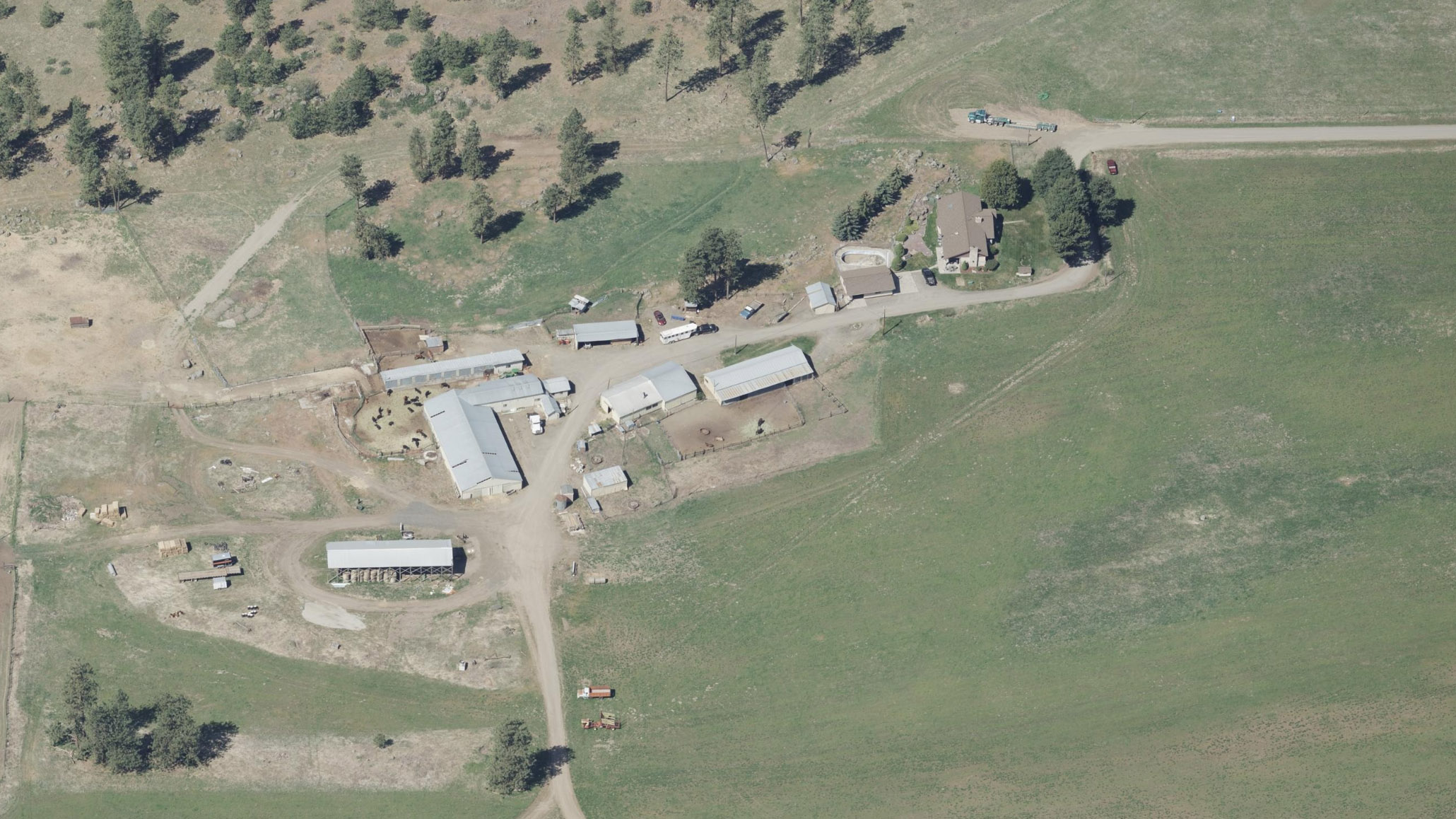
Before and After Imagery
Compare before images to see the impact of the fire on neighborhoods and farms in this Washington community. The GIC offers imagery from three previous Blue Sky collections: July 2022, May 2021, and July 2019.