Gray Sky Event: Tornado Hits Metro Areas in Houston, Texas

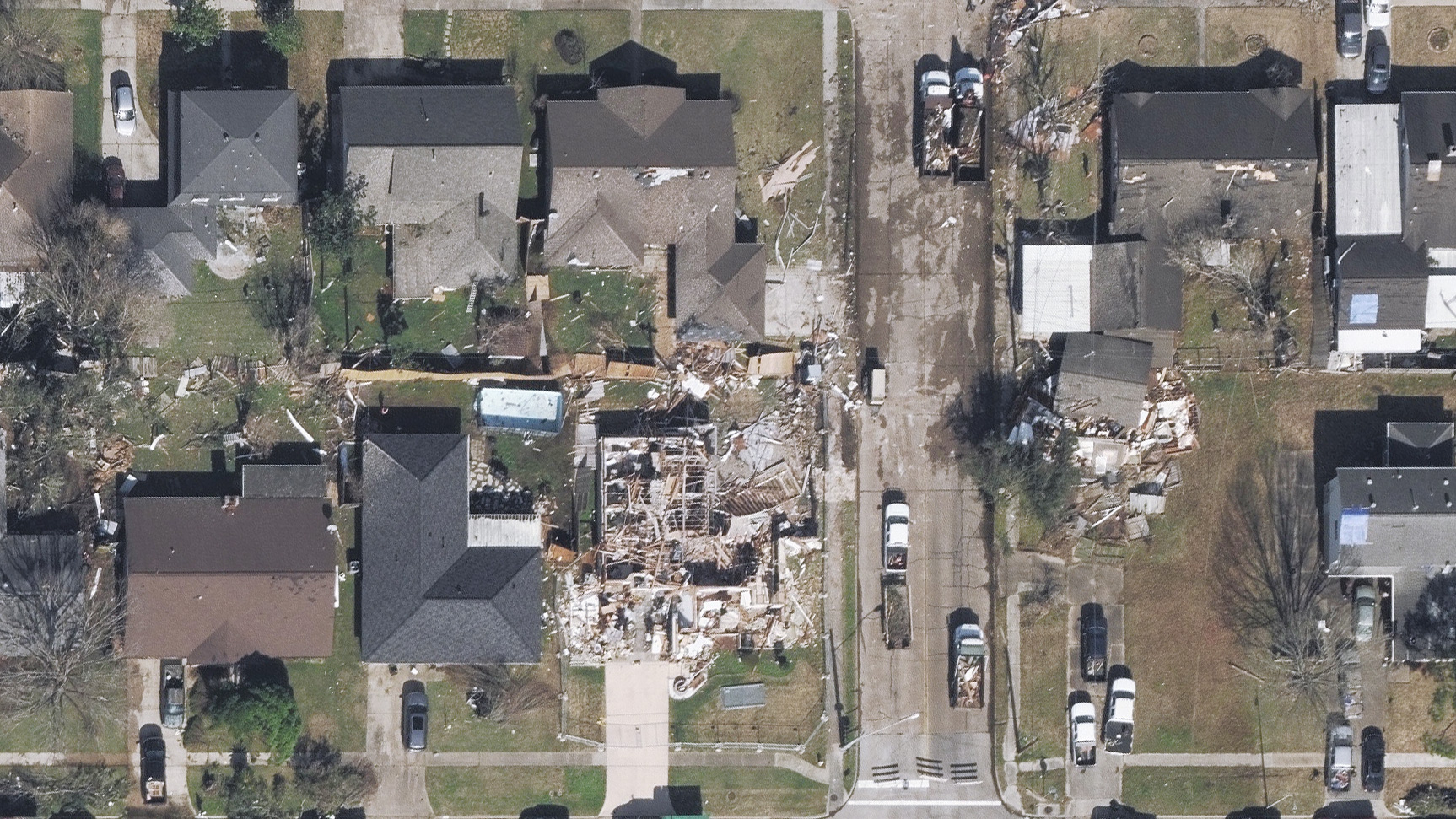
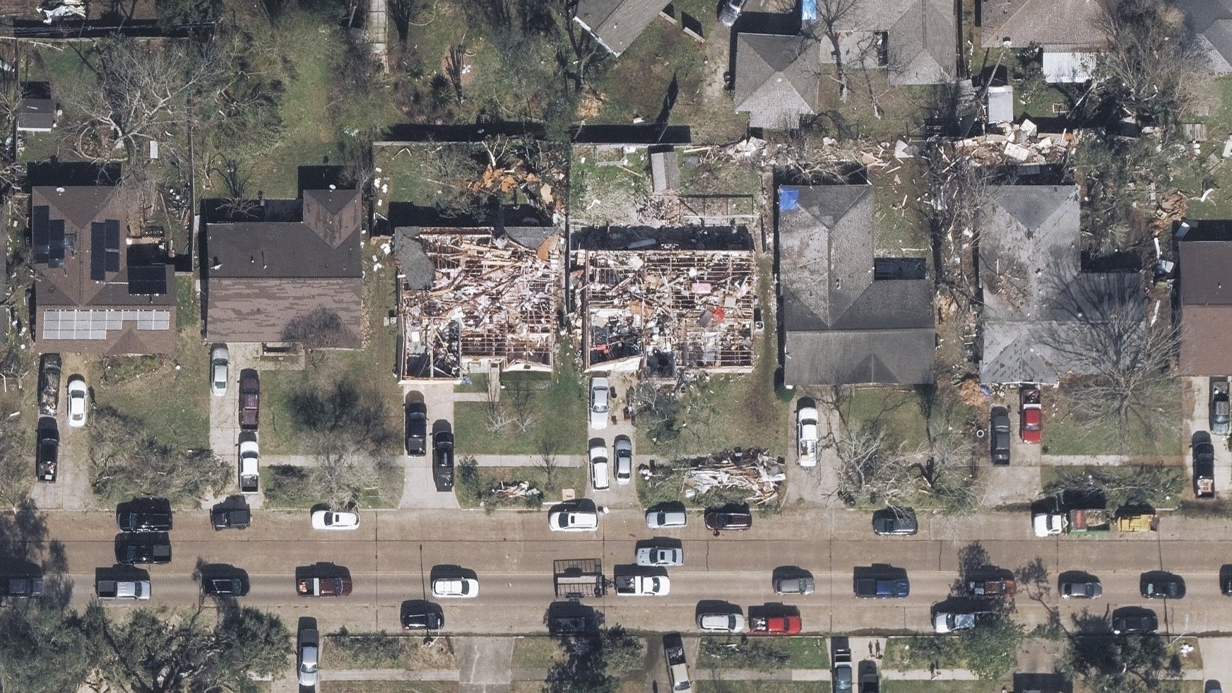
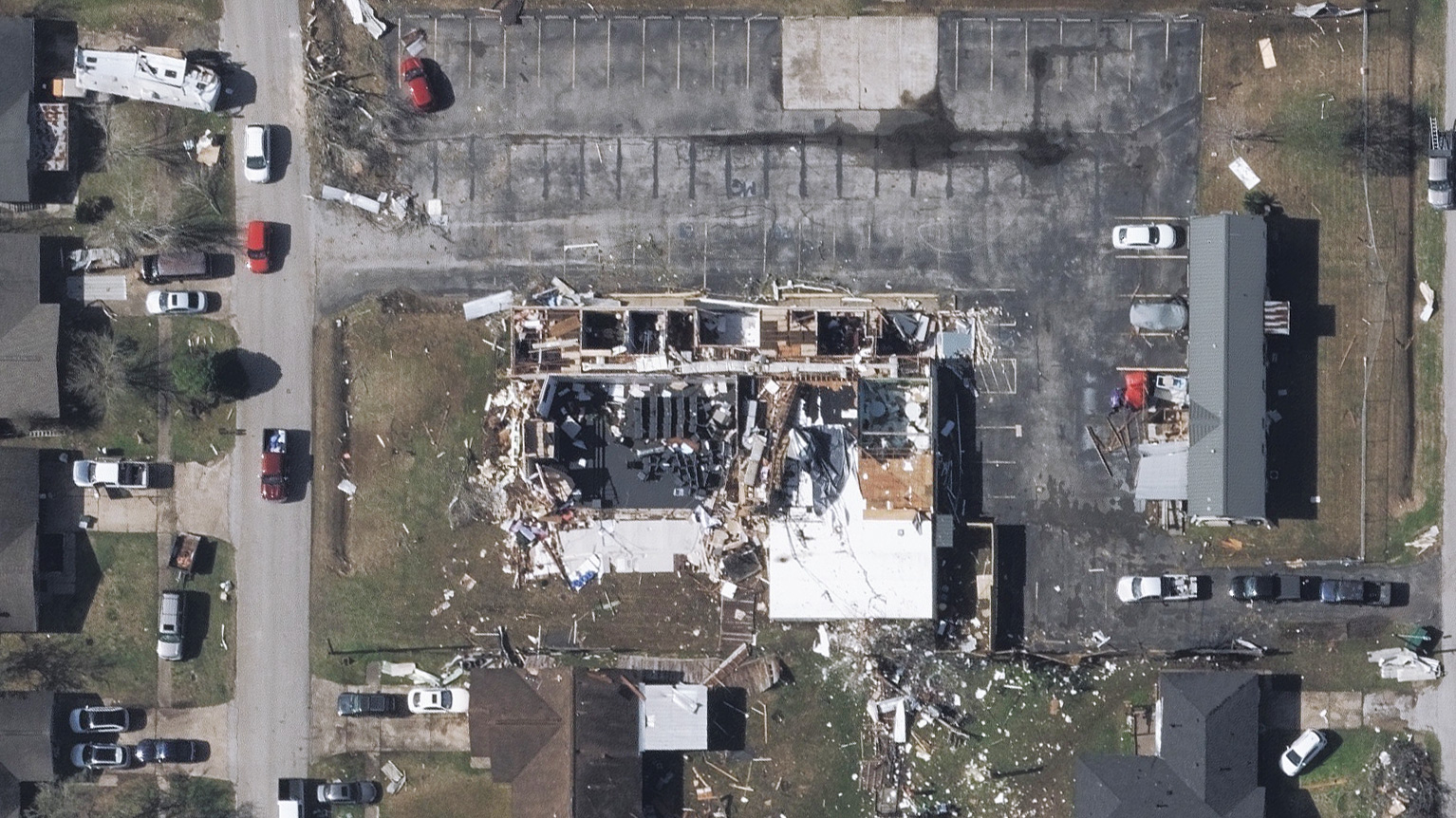
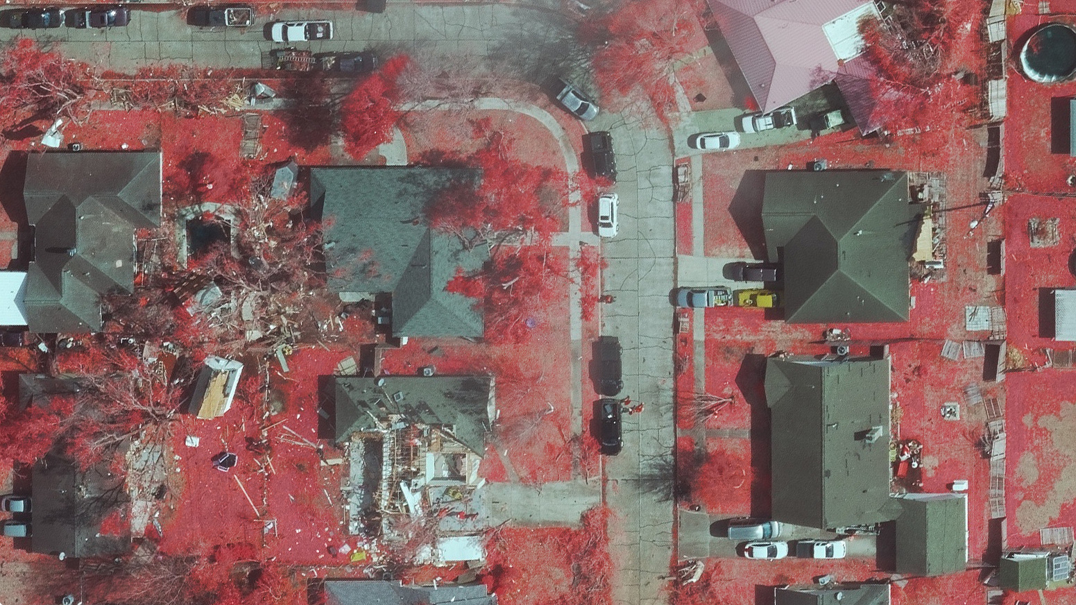
On Tuesday, January 24, a fast-moving tornado touched down in multiple metro areas of Houston, Texas, setting off the first Tornado Emergency ever issued by the National Weather Service in Southeast Texas. The damage inflicted to communities across these areas was indicative of an EF2 tornado, with homes missing roofs or crushed beneath large trees and debris blocking roadways. Large commercial trucks were overturned on beltways and multiple power lines were impacted, leaving thousands of Texans without power.
Shortly after the tornado hit, our Gray Sky team was activated to begin prepping for disaster imagery collection over the devastated community. Once damage on the ground was determined, our planes began readying for flights Wednesday over the areas of Genoa, Golden Acres, Pasadena, Deer Park, Wooster, and Baytown.
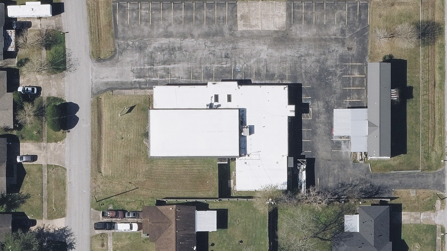
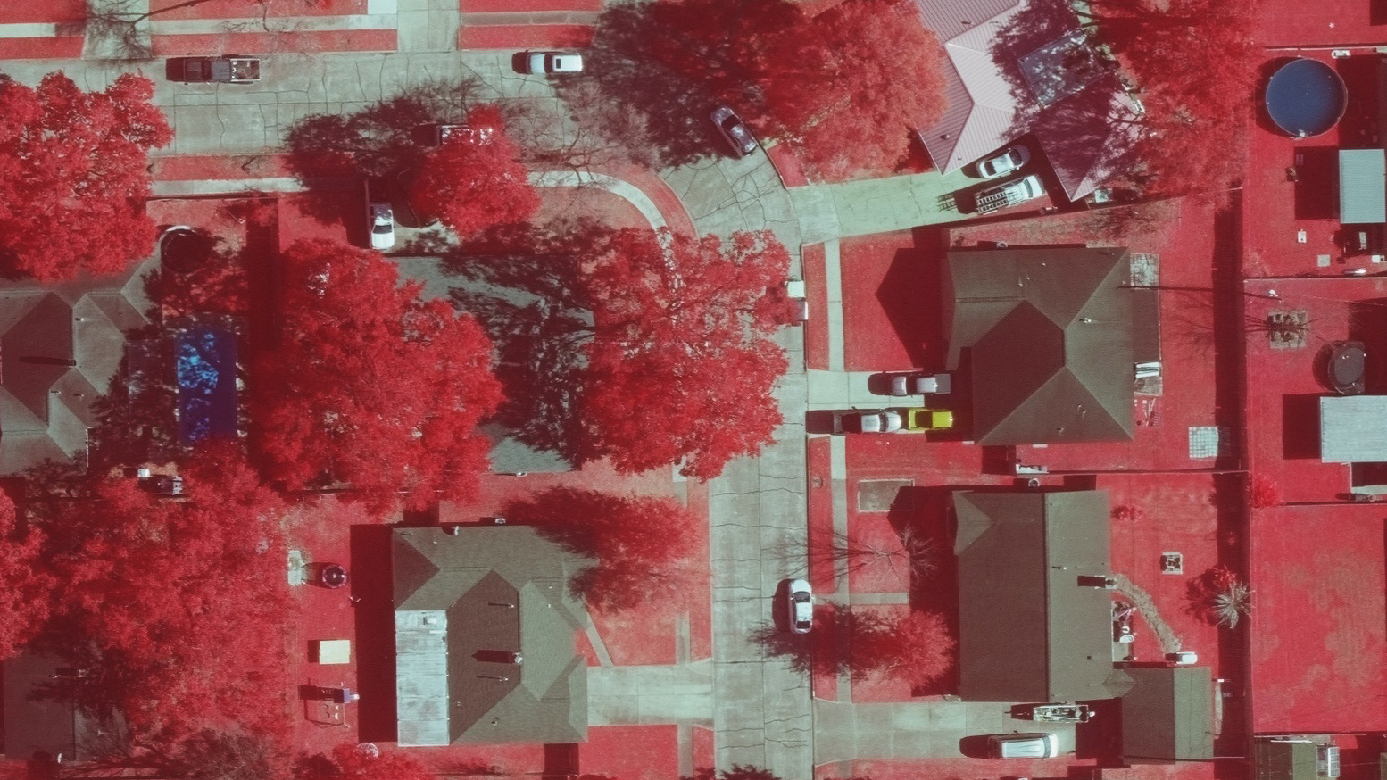
The sky cleared and our planes were able to collect Oblique and Ortho imagery of the event and the data was processed and published to our Viewer platform within 24 hours after wheels down. Below is a sample gallery of some of the imagery we were able to capture, showing the scope and level of impact these communities are grappling with today.


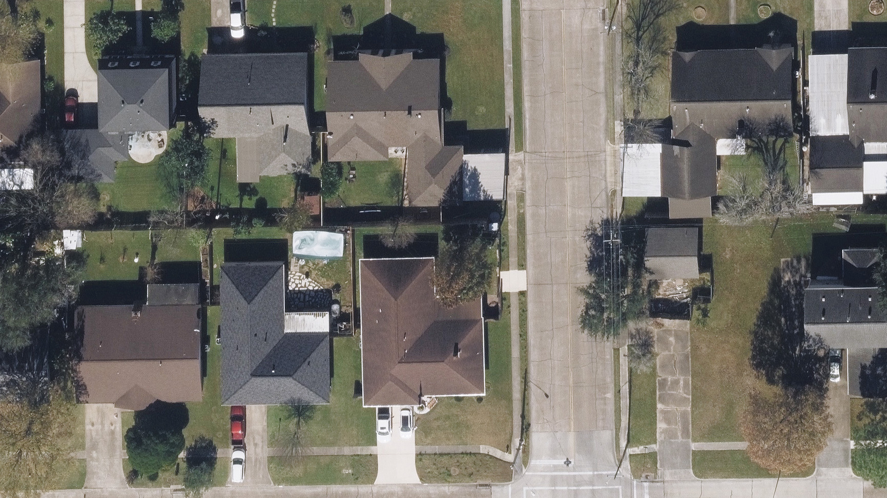
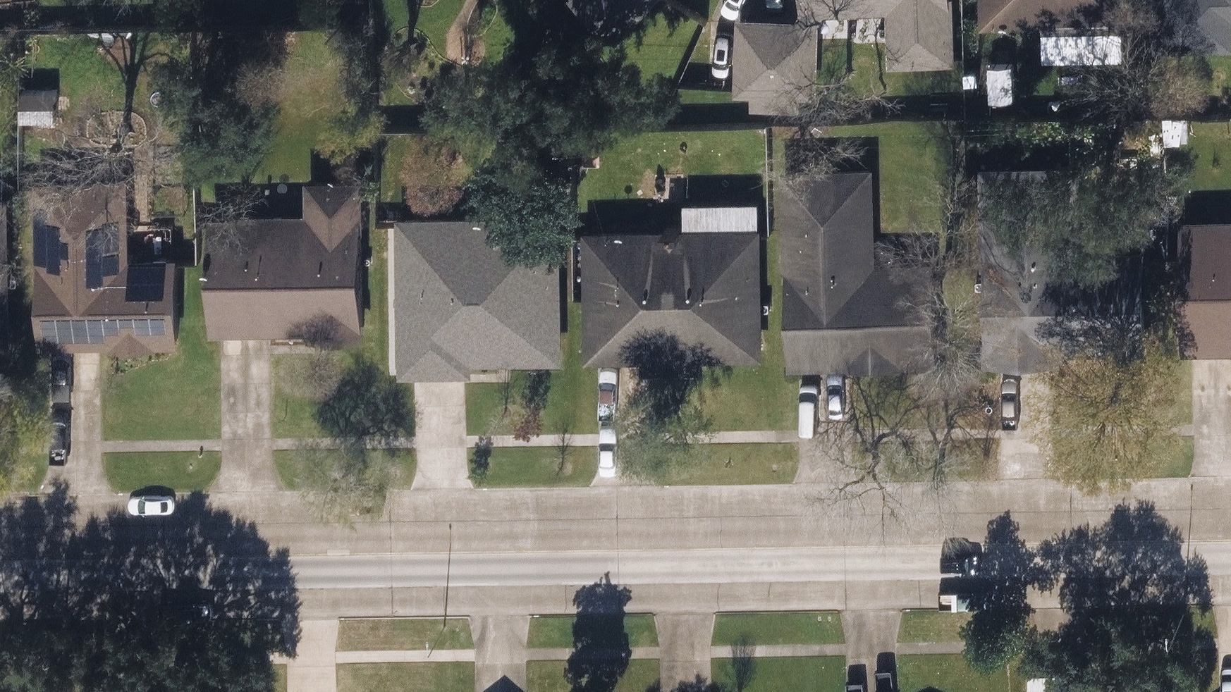
Besides recently acquired Gray Sky aerial imagery, the GIC library has historical imagery of the area, helping our members see what existed before the tornado occurred. These pre-CAT images help with before-and-after comparisons, showcasing the level of damage suffered by residents in these communities. In addition, Damage Assessment is available to help GIC members remotely review property damage so they can triage and proactively begin the claims process to help those in greatest need.