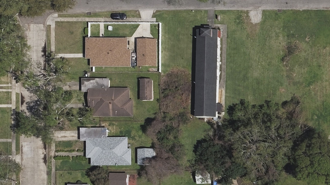
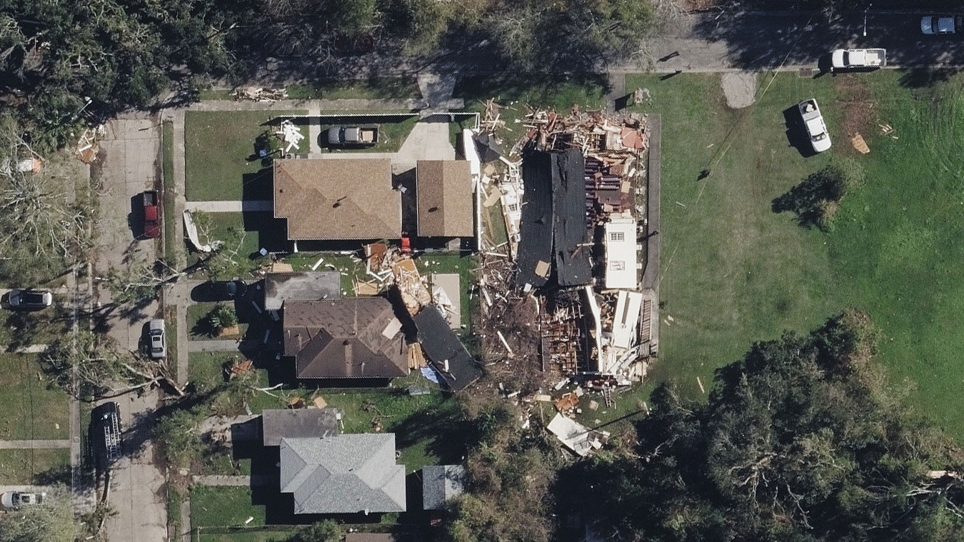
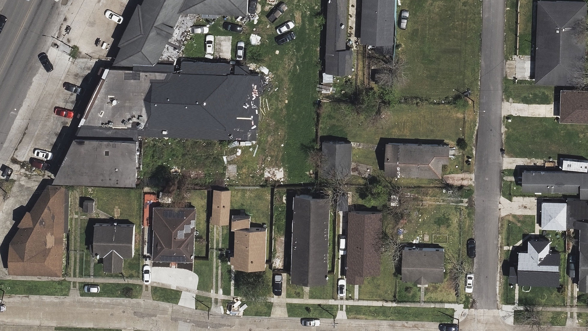
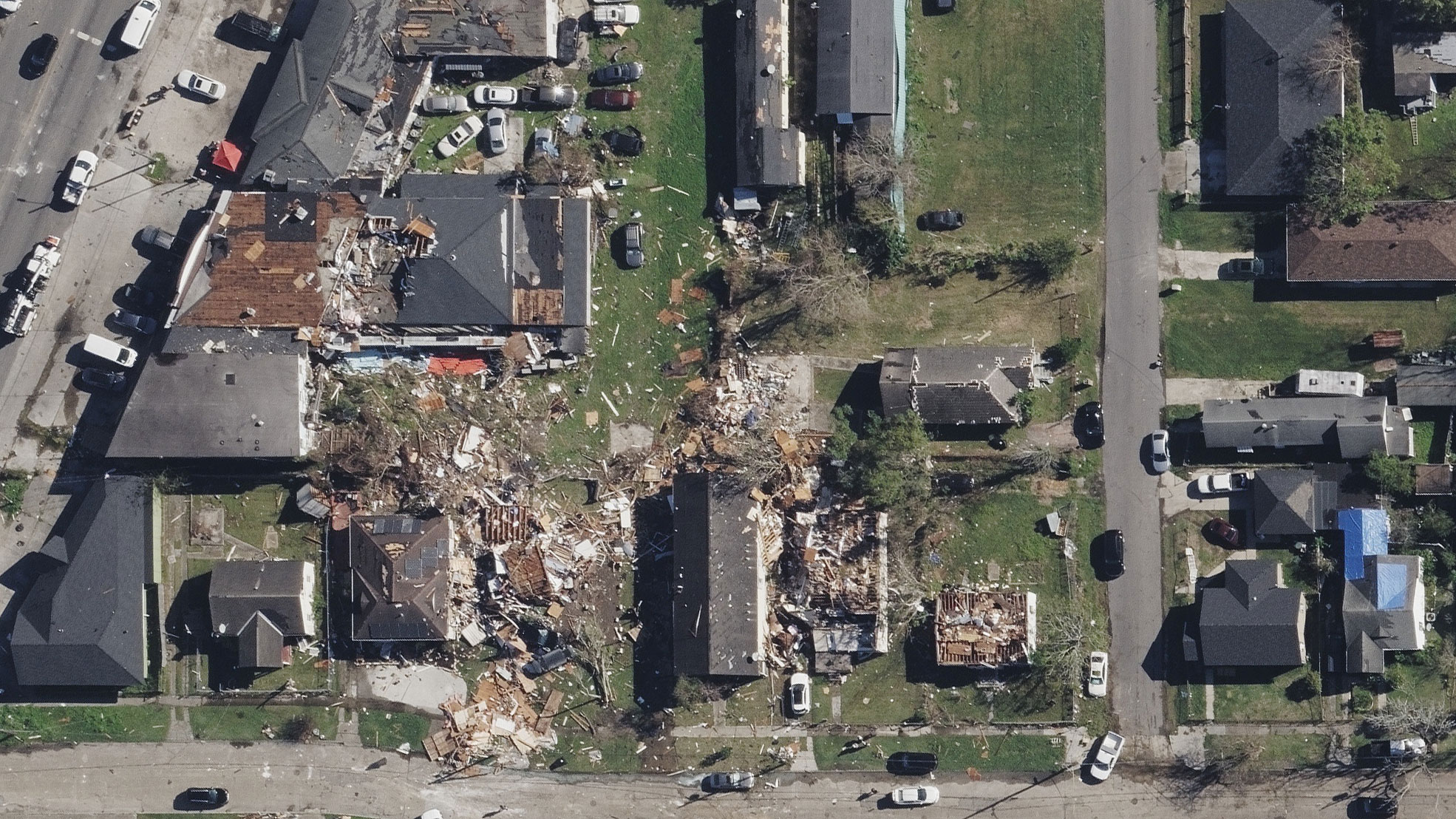
Gray Sky Event: New Orleans Tornado
The year is not over for natural disasters as evidenced by severe snowstorms, blizzard warnings, and more than 50 tornados reported across the South this week, including a destructive tornado that touched down in New Orleans on the afternoon of December 14, 2022. Our Gray Sky team reached out to GIC members to determine the needs of collecting damaged areas and were able to get up into the air less than 24 hours after the event.
The area we focused on where significant damage occurred, including the town of Gretna, Louisiana, which is across the Mississippi River from New Orleans where thousands of structures were damaged. Power outages were impacting more than 50,000 people following the tornado touchdown. Our Gray Sky aerial imagery provides needed–and necessary–insights into damage on the ground for our insurer members. It supports proactive claims management, weeds out fraud, and starts to the process of restoration for so many.
Damage Assessment: Automated Insights in Seconds
Following this hurricane, our latest Elements product, Damage Assessment, was applied across all imagery collected from this Gray Sky event. Damage Assessment helps insurers identify in seconds which properties sustained the most damage and to what degree. Insurers can view property attributes and features on pre-event imagery and compare it against the damaged property to better understand the scope of destruction.
High-resolution aerial imagery from this event has already been shared with members and emergency managers. We’ve posted a small overview gallery below to give a small glimpse into the hardest hit areas and how our Oblique and Ortho imagery can provide much needed context and ground truth.