Update from the field
The coordinated flying missions of Sanborn Map Company and Quantum Spatial are on task. As of this writing, Sanborn reports completion of 3” oblique/nadir aerial data of Goliad, Cuero, Port Lavaca, Rockport, Port Aransas and Aransas Pass and 4-6” nadir data of the …
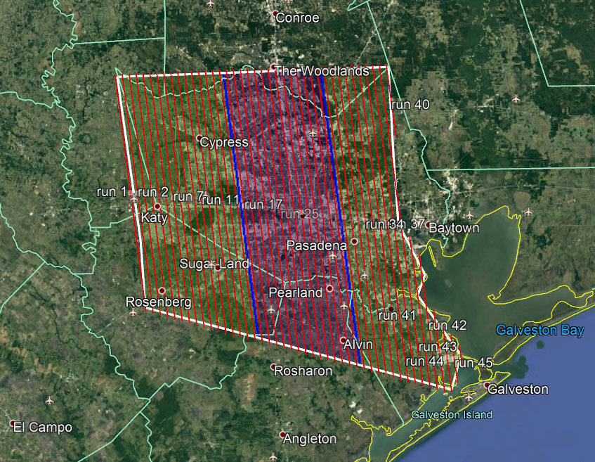
Quantum has acquired 95% of the 4-6” nadir data for the AOI of the Greater area of Houston assigned. They credit “an opportunistic weather pattern, ATC providing amazing air traffic separation, Vexcel’s timely support, and fantastic coordination by the command center in Austin.”


Leave a Reply
Want to join the discussion?Feel free to contribute!