Our first Super Hi Res 360 degree Imagery is online
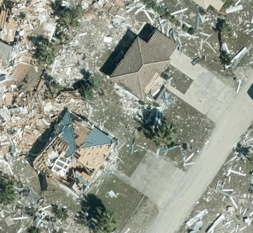
Captured with Vexel’s highest resolution camera, we now have our first 360 degree oblique images of Hurricane Michael’s devastation online. With oblique views, you can look at the sides of houses and not just the roof. You can also rotate to see up to 4 views of a single property. As of this evening we have Port St. Joe, Panama City, Mexico Beach, and Dothan available, with more imagery being published throughout the evening.
For comparison, here is the Nadir view of the same location as the image featured above.
Oblique 360 imagery is currently available in the NICB Web application. Click here to view the imagery.
https://maps.geointel.org/app/nicb/?extent=-9509314.5367%2C3497107.2247%2C-9509171.2173%2C3497179.1083%2C102100
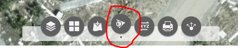
To turn on the Oblique imagery viewer, look for the Oblique Viewer button in the toolbar at the bottom of the screen. Once loaded, you can click on the main map to bring up the corresponding oblique image in the viewer. There you also have access to tools like a ruler, compass and exposure adjustment.
This imagery is also available programmatically via REST api or WMTS layer here:
https://maps2.geointel.org/server/rest/services/Vexcel_Gray_Sky_2018_Oblique/ImageServer
