Gray Sky Event: Mississippi Tornadoes
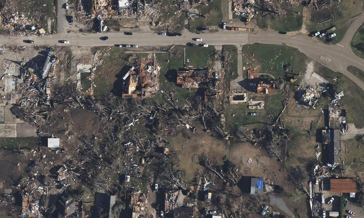
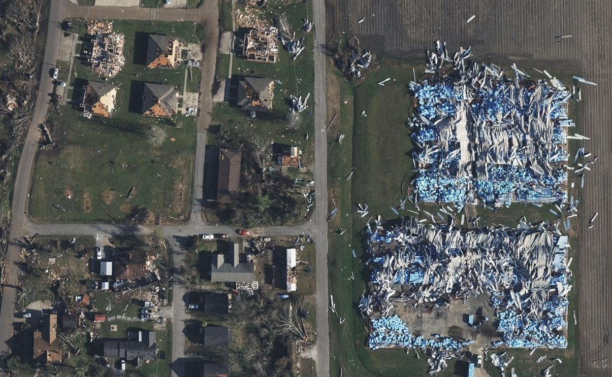
A massive supercell storm system triggered multiple tornadoes that touched down through parts of Mississippi and Alabama this past weekend with some of the hardest hit areas being Rolling Fork, Silver City, and Winona. The tornado that swept through Rolling Fork was rated a 4 on the Enhanced Fujita scale by the National Weather Service with wind gusts between 166-200mph, and stayed on the ground for 70 minutes with a path 59.4 miles long. This made that particular tornado one of the more rare types recorded in Mississippi weather history.
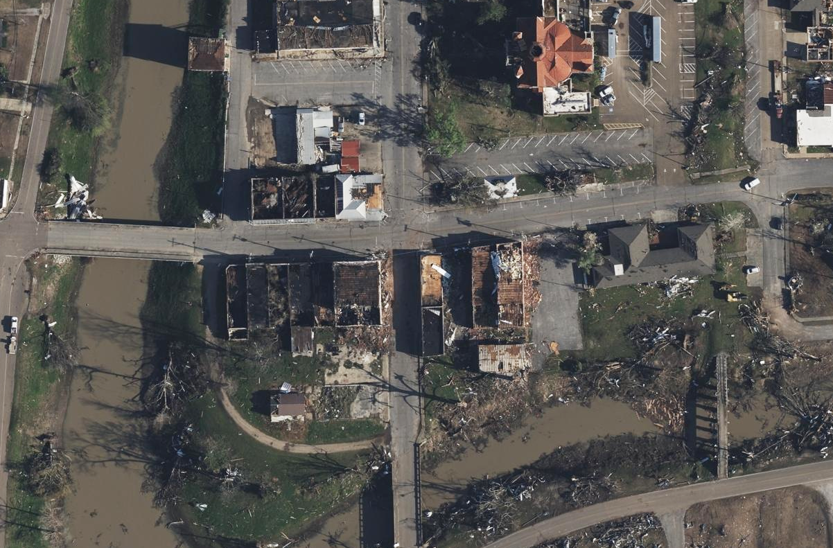
Our Gray Sky team was activated and our planes were able to get up in the air quickly to begin collection of 10cm resolution aerial imagery across the devastated area. Aerial imagery from the event is published and available to our GIC members and emergency managers.
Automated Damage Insights
Following the publication of imagery, we went to work ensuring our Elements: Damage Assessment data would be available and ready as quickly as possible. Damage Assessment allows insurers to pull automated insights on their impacted PIFs to get data on a damaged home. In seconds, insurers are able to see a catastrophe score, missing material score, over damage and debris percentage, as well as an approximate FEMA classification score.
Below is an example of Damage Assessment being run on an impacted home in Rolling Fork, as well as a gallery of images from just a small portion of a what we collected for this event.


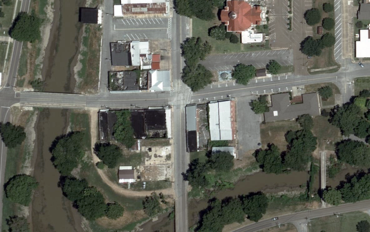
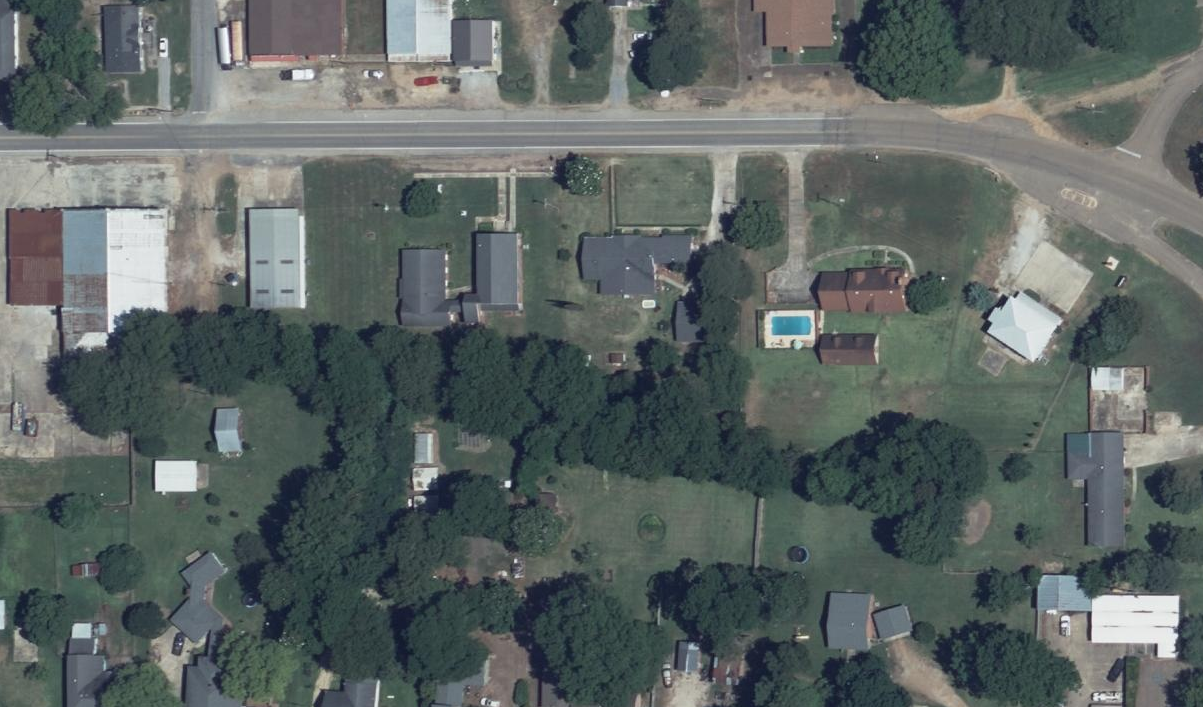
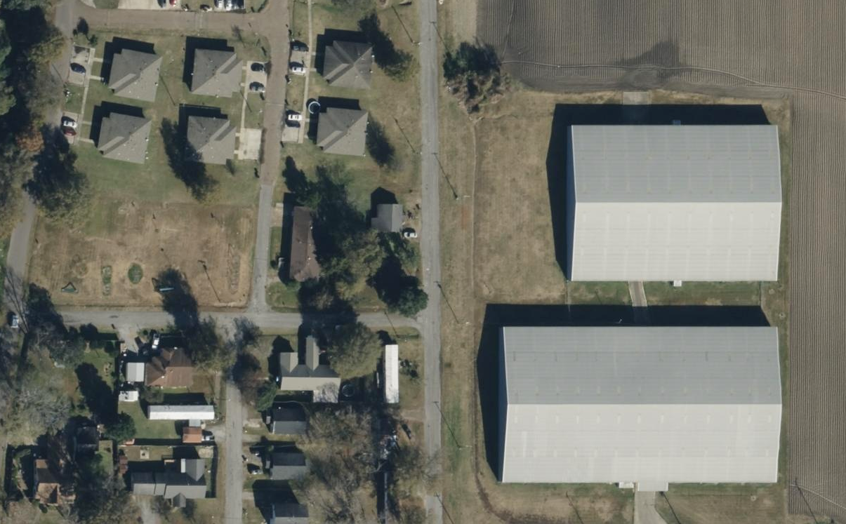
The GIC also has before images of the properties struck by the tornadoes. These help with before and after comparisons, showcasing the level of damage suffered by residents in these communities. Damage Assessment is available to help GIC members remotely review property damage so they can triage and proactively begin the claims process to help those in greatest need.