GIS for Disaster Response – Part 2
In this blog series, we interview GIS and emergency management expert, Richard Butergerit, on the use of GIS technologies to improve catastrophe response.
GIS Technology’s Impact on Disaster Preparedness & Response
In last week’s blog post, we talked about the trend toward more frequent disasters across the country and introduced you to Richard Butgereit, our Director of Catastrophe Response.
This week, we continue the conversation by diving deeper with Richard into how GIS technology is being leveraged to improve disaster preparedness and response.
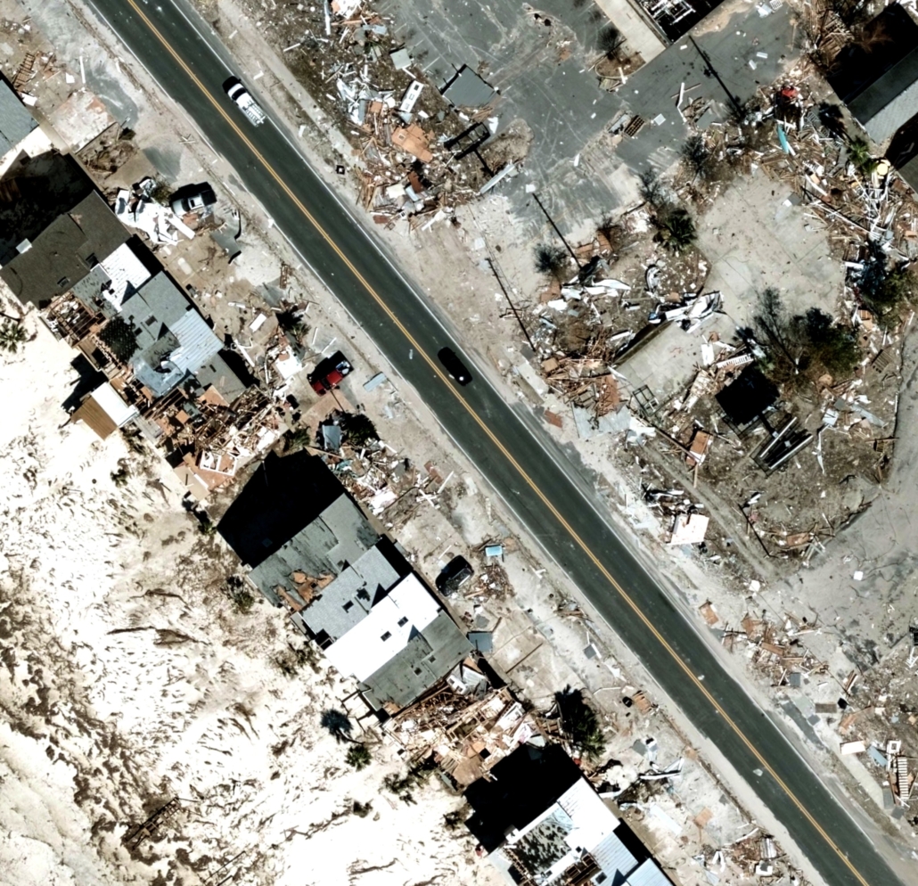
What role does GIS technology play in disaster management?
Richard: “One of the big misconceptions is that GIS is simply a mapping tool. But GIS is about much more than that – it is an analytical, data management and visualization tool that when combined with remote sensing, can provide a wealth of invaluable location information to the public as well as governments, public safety organizations and commercial industries.
When it comes to disasters, GIS is crucial in making responders and the public aware of everything from current conditions, predicted future conditions, tracking natural disasters, and modeling damage to accurately determining the location of 911 calls.”
How does GIS help prepare us for disasters?
Richard: “GIS gives us the opportunity to better leverage location information to forecast, model, and understand what could happen and when we might expect conditions to occur at a given location. This is crucial in helping prepare for a disaster because it can enable public safety organizations, first responders, and even insurers to be better prepared for how to respond to a catastrophe – before it strikes.”
How does GIS play a role in the initial response to a disaster?
Richard: “Real-time information is crucial to a catastrophe response effort as a whole. GIS is instrumental in leveraging locational information in order to help organizations, local governments, and state governments improve their response time. Monitoring traffic conditions and road closures, 911 calls, storm reports, social media posts, and power outages all inform the initial response to a disaster.
GIS provides information such as where the storm struck, where the affected populations are located, where the roads are closed, and more. By leveraging this level of intelligence, teams can be more effectively dispatched to provide aid.”
Tell us more about 911 calls. How does GIS play a role?
Richard: “As mobile technology becomes ubiquitous, quickly locating people in need during an emergency has become a more difficult task. Without a fixed landline location, emergency responders are often dispatched to the wrong location, or the response time for an emergency is lengthened.
A localized emergency begins with a 911 call. GIS, leveraging the right oblique aerial imagery, has helped solve this issue by assisting in “visual triangulation,” the use of oblique images to determine the location of a point in space. Leveraging location information contained in this imagery, emergency responders can better identify landmarks in the vicinity of incidents.
These visual cues enable responders to locate citizens in need of help quickly and with precision.
Additionally, oblique aerial imagery has transformed the level of critical insight an emergency responder has access to before arriving at an incident. Crucial data, like the location of emergency exits in a building, is now available – arming emergency responders with the knowledge to make them more effective in response efforts.”

 Geospatial Insurance Consortium