Alabama Tornado Response: Capturing the First Major Disaster of 2021
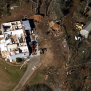
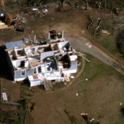
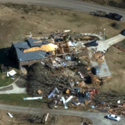
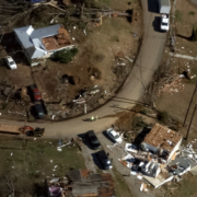
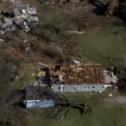
This past week, a devastating EF-3 tornado tore through large swaths of Jefferson County in Alabama, at times reaching wind speeds of up to 150 mph. It carved a path of destruction and significant damage nearly 10 miles long, impacting homes, schools and businesses.
The hardest hit area of this storm centered around Fultondale, a densely populated suburb of Birmingham. One of the top priorities for communities such as this is evaluating the true scope of the event and how emergency managers and insurers can help the residents get back on their feet as soon as possible.
Our Gray Sky Program: A Commitment to Capturing Post-CAT Imagery
We’ve been committed to capturing and collecting high-resolution post-disaster aerial data since 2017, providing needed information to our customers to help change outcomes for response, recovery, mitigation and preparation for future events. We’ve seen and heard the difference it makes to those working to repair the damage done to communities large and small. We know the value real ground truth can provide when often the destructive nature of a storm prevents travel into an impacted area.
At the GIC, our Gray Sky program is the very heart of what we do and why our organization was founded in the first place. We’ve been fortunate partners to witness the good that comes from clearly understanding the level of devastation by using clear, accurate aerial imagery to help communities rebuild.
The Tornado’s Path in Alabama
A key part of capturing any disaster is understanding where it started, where it went, and how it ended. Tornado warnings and watches can only help communities prepare up to a point; the reality is that when a tornado starts to form, residents have on average only 13 minutes to prepare and react. This particular tornado struck later in the evening on Monday, January 25, meaning that come Tuesday morning, many were waking up to discover what had really happened.




 Geospatial Insurance Consortium