Transforming the Insurance Industry through Disaster Response
Natural disasters are not a new phenomenon, however as these events increase in frequency, insurers must be able to assess damage quickly and respond rapidly to claims, so that communities can get back on their feet quickly.
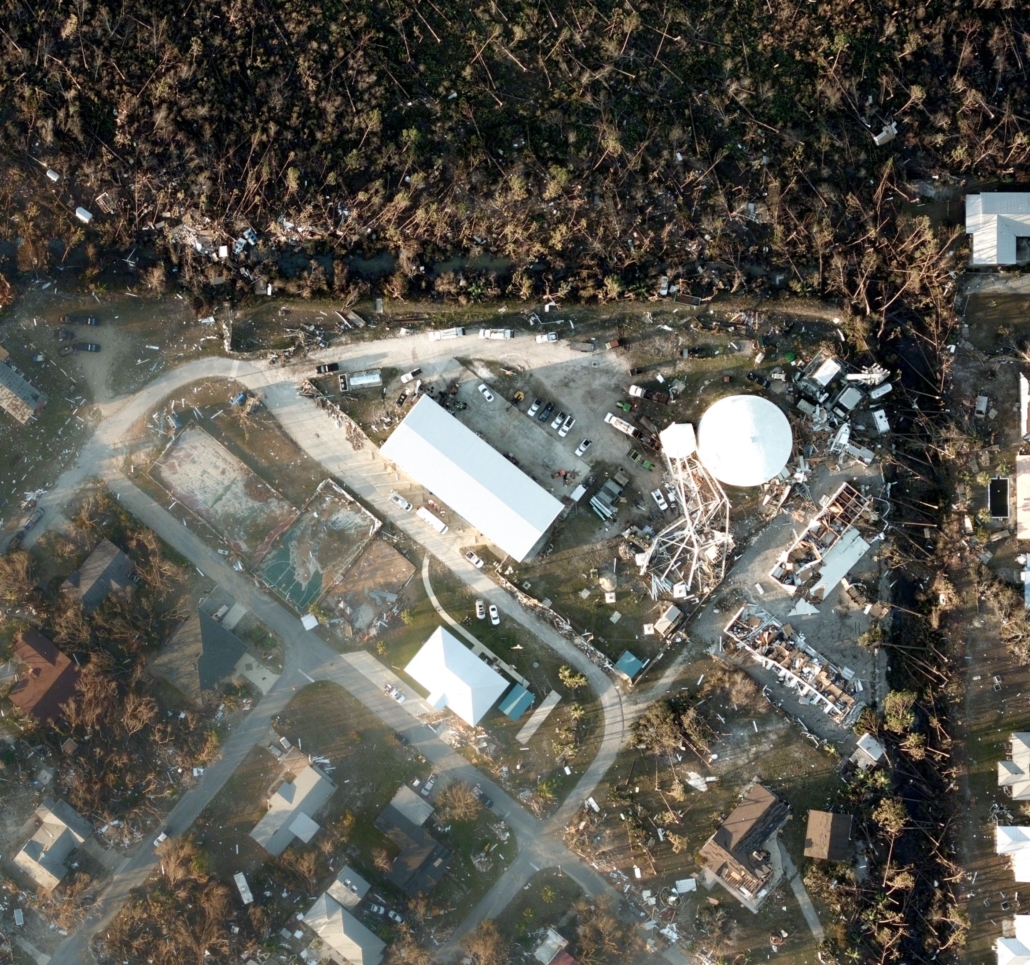
When Hurricane Michael hit the US in 2018, it was one of the strongest hurricanes in history, devastating more than 4,000 miles of Florida Panhandle’s coast. Once the storm cleared, the GIC worked quickly to deploy its Gray Sky Response Program. It sent aircraft into the region carrying Vexcel Imaging’s sophisticated aerial camera system, the UltraCam Osprey, to assess damage. Over the span of two and a half days the GIC flew 85,000 sq km, prioritizing areas with the highest population density to capture ultra-high-resolution imagery.
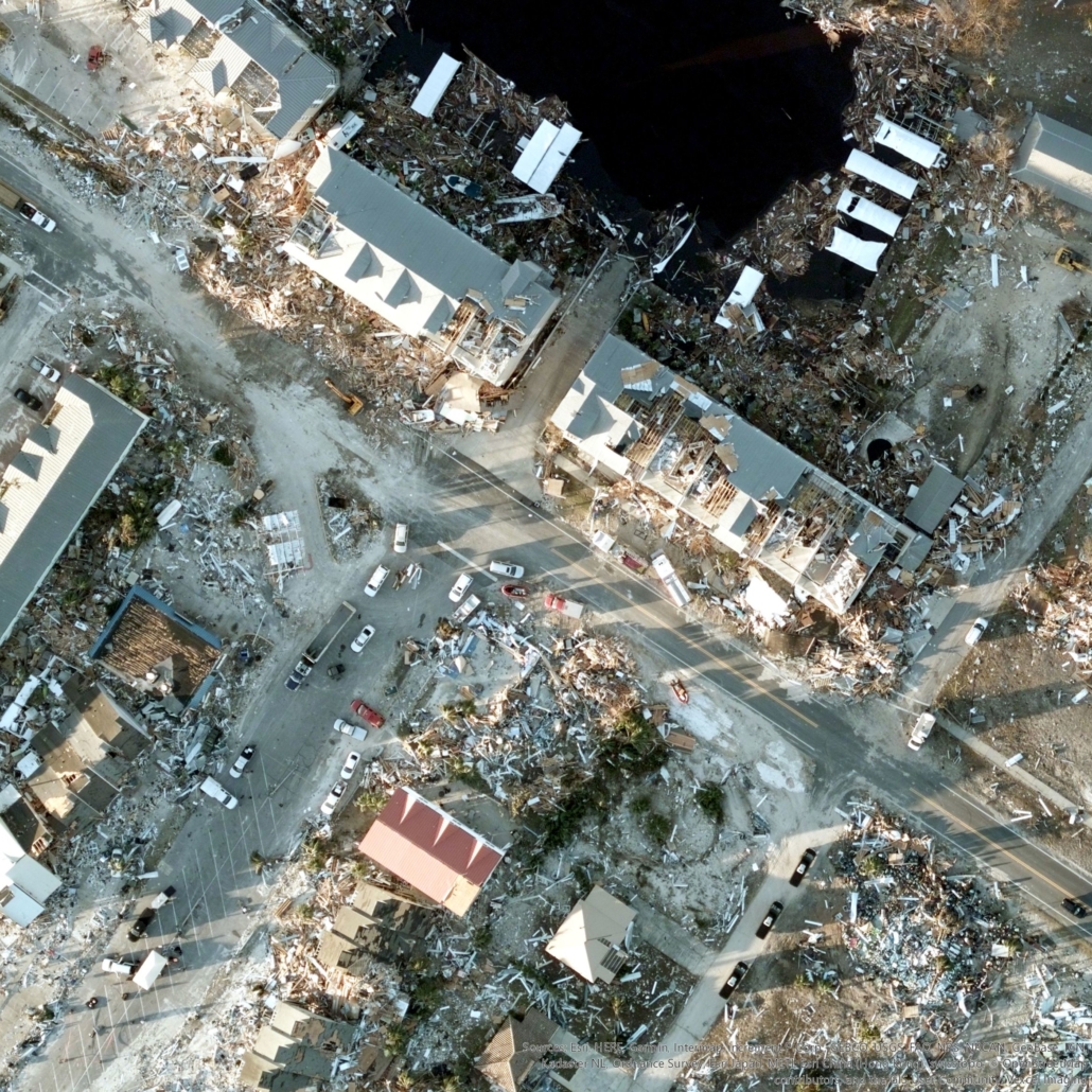
The images were analyzed and damage was assessed through the use of Esri’s GIS cloud-based technology system. Before and after images were compared and layered on policyholder data to prioritize those with the greatest need for relief.
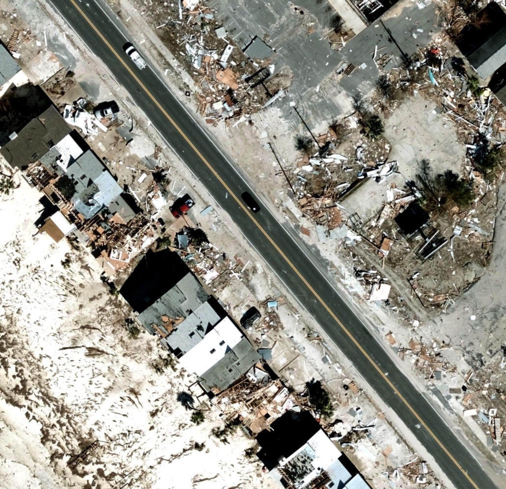
Post-Hurricane Katrina, the average rate for claims processing was one month. Because of the GIC’s rapid response during Hurricane Michael, insurers were able to validate the damage within 24 hours after the storm, helping insurers pay claims within that same day, so that people affected could begin rebuilding their lives.
This is one example of how through strategic partnerships, like Vexcel Imaging, the National Insurance Crime Bureau, and ESRI the GIC is transforming the insurance industry’s disaster response time and its ability to fight fraud in the aftermath of disasters like Hurricane Michael.
This video, produced by ESRI, tells the full story of how the GIC played an instrumental role in making people and communities whole again after this historic storm.


 Geospatial Insurance Consortium
 Geospatial Insurance Consortium