Ventura, CA Fire Imagery Flown and Deployed to Map App
The conditions improved enough to fly the expanded areas on Wednesday. The imagery is now available on the Geointel Web Map.
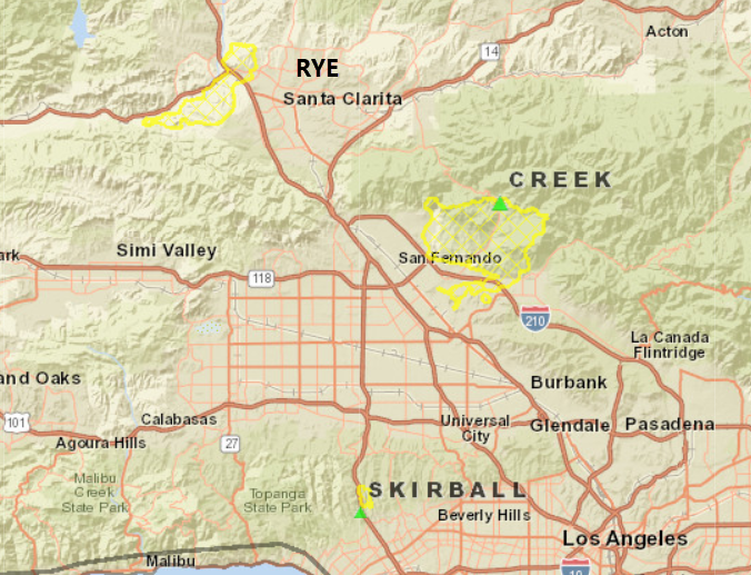
Reported by Sanborn and Esri.
The conditions improved enough to fly the expanded areas on Wednesday. The imagery is now available on the Geointel Web Map.
Reported by Sanborn and Esri.
![]()
![]()
Global leaders in aerial imaging. Vexcel provides industry-leading camera sensors, a dedicated fleet of fixed-wing aircraft, and the largest, most accurate aerial imagery and geospatial data program on the planet.

Large-format UltraCam cameras & sensors.
vexcel-imaging.com
Aerial surveys by fixed-wing aircraft.
kasurveys.com
Aerial imagery and data for government and business.
vexceldata.com