
Be Better Prepared for Unpredictable Storm Seasons
Aerial imagery paired with property analytics offers detailed analysis of buildings, helping you better understand potential risk and work with customers to get them ready for the storm seasons ahead
127 Million Properties

40+ Property Attributes
99% Population Coverage
What information could help you better evaluate the level of risk on a building? Type of roof? Its current condition? What the defensible space conditions are around the home? All of these property attributes—and more—are available in our Property Report. By combining AI with our best-in-class, timestamped aerial imagery, you get access to 40+ building and property attributes delivering multiple details on a property.
Use these automated insights to strengthen your underwriting, shore up quoting, and evaluate potential risk as we head into the storm season, where research is predicting 5 major hurricanes*. Be proactive and take charge of your PIFs by building your knowledge on a property with detailed property insights.
*Colorado State University 2024 Atlantic Hurricane Season Forecast

Deteriorating Roof Conditions
As part of the Property Report, you’ll get multiple pieces of information related to a property’s roof:
- What type of condition is it in
- What is it made of, is there discoloration like vent staining or water pooling
- How many chimneys/AC units/or satellite dishes does it have
- Does it have solar panels on it
Use these details to keep your customer informed of needed repairs before a disaster strikes to reduce the level of damage.

Defensible Space Boundaries
A growing number of areas are experiencing an increase in wildfires. Properties that are at greater risk have trees (and other vegetation) close to the building that increase the ability for fire to take hold and cause damage. Certain states, like California, have enhanced their Defensible Space laws to protect properties from the threat of wildfire.
The Property Report shows:
- Trees within 5, 30, 100, and 200 feet of the home
- Buildings within 5, 30, 100, and 200 feet of the home
This valuable information can help show a customer the increased fire risk to their property and why defensible space buffer zones are so critical.

Tornado Alley
In areas where tornado danger is high, it’s important to understand what elements around a building may cause damage and pose higher risk to a property.
This particular building has a tree partially covering its roof, it also has a free standing pool. While tornadoes are unpredictable in where they hit, being able to communicate to a customer on items near and around the building that could cause further damage are an essential part of the Property Report.
See for Yourself.
Get a free AI-derived custom report on one of your properties. Complete the following form and enter in the location and download a full report.*
*Available for a limited time through June 15, 2024
Get A Free Custom Report
Search for a U.S. Property to download a custom report.
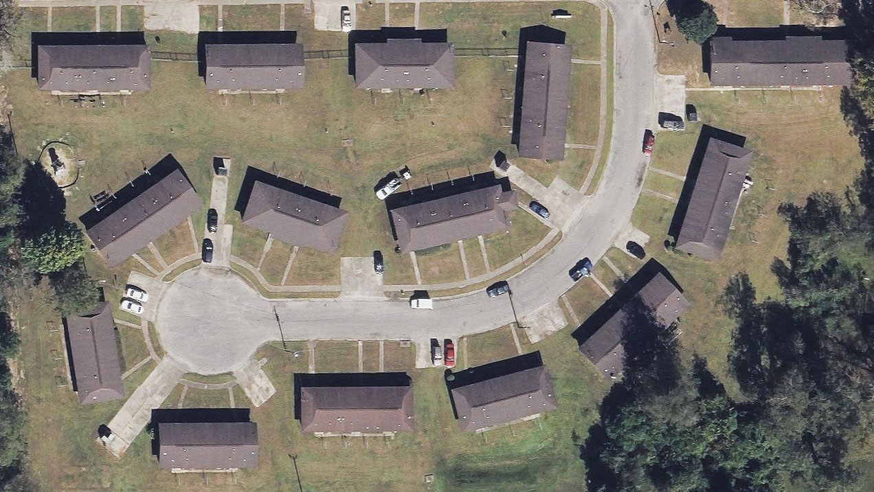
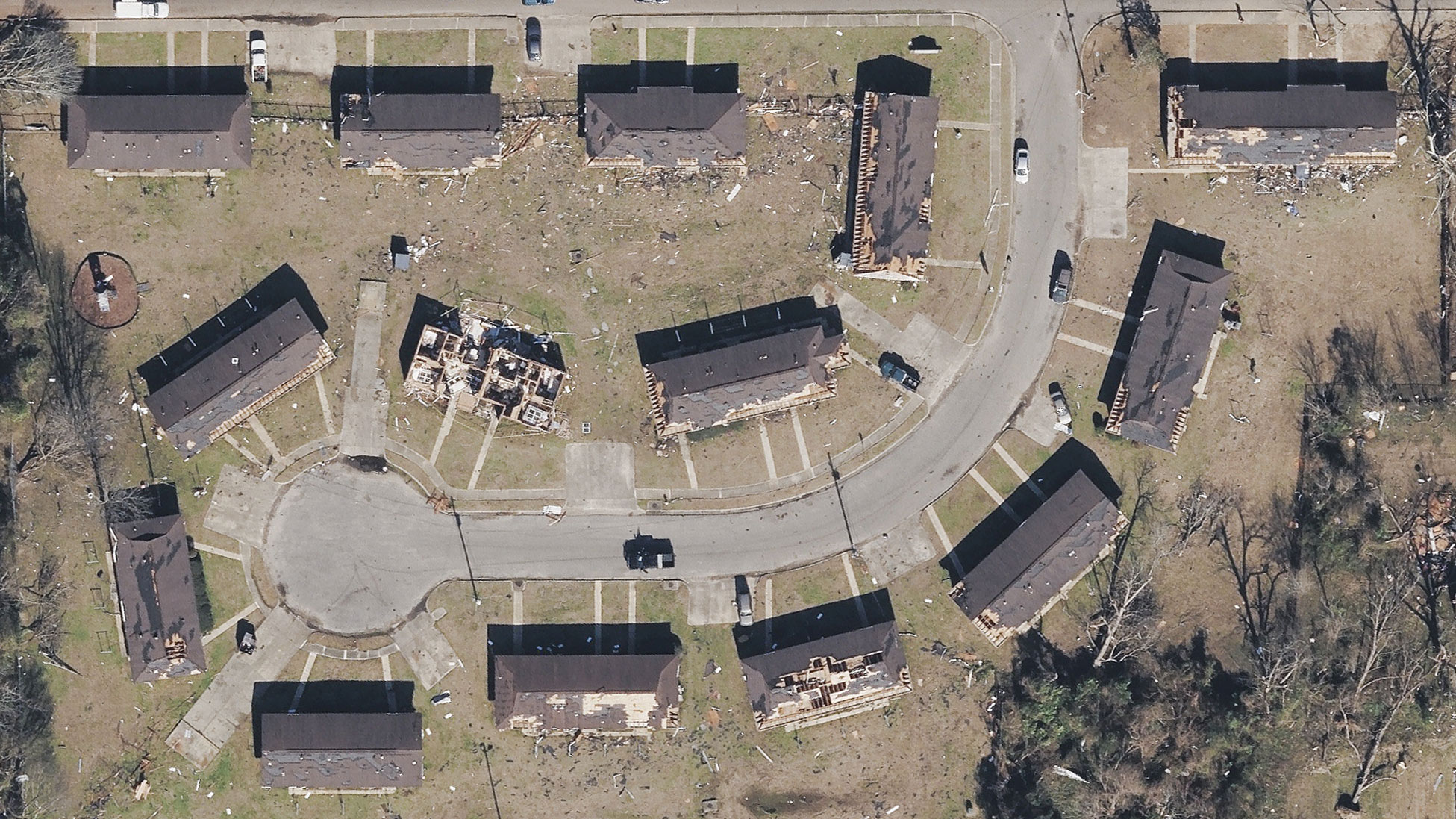
And when disaster hits?
If a tornado, hurricane, or wildfire does occur, the GIC provides automated Damage Assessment information on impacted properties. Quickly assess the level of damage to begin proactively working with your distressed customer before a claim even needs to be filed.

Covering 100+ Million U.S. Properties
Learn how to add custom PDF reports to your claims and underwriting workflows. Or, build these AI-derived Elements products into your platform with our APIs and SDKs.
![]()
![]()
Vexcel is the operations partner for the GIC.
Global leaders in aerial imaging. Vexcel provides industry-leading camera sensors, a dedicated fleet of fixed-wing aircraft, and the largest, most accurate aerial imagery and geospatial data program on the planet.

Large-format UltraCam cameras & sensors.
vexcel-imaging.com
Aerial surveys by fixed-wing aircraft.
kasurveys.com
Aerial imagery and data for government and business.
vexceldata.com