Capturing the Scope of Damage from Hurricane Ida
Collecting the damage caused by Hurricane Ida has been a massive effort by our team of experienced pilots. The vast expanse of the destruction could not be captured in just a day; it took several days to ensure a proper and appropriate collection.
As storm waters begin to recede and access to areas once inaccessible open up, a clear picture has emerged for continuing aid and beginning restoration efforts. And our imagery helps drive both response and restoration efforts by providing real-world context for these impacted communities.
A Path of Devastation
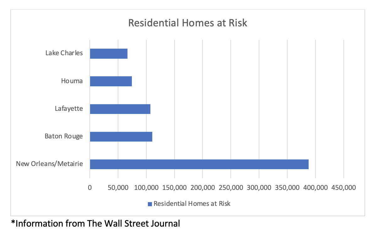 Hurricane Ida was a Category 4 storm with winds up to 150 mph—just 7 mph shy of being a Category 5. Damage estimates have been pegged between $15-20 billion with a number of residential properties identified “at risk” per the information* in the chart on the right. The numbers shown reflect nearly 750,000 homes.
Insurers have already begun proactively addressing damaged areas by using our comprehensive imagery library from Hurricane Ida. While some loss adjusters wait to gain access to impacted areas, remote claims management with this aerial data is giving GIC members a head start to getting their customers needed assistance.
Insurers have already begun proactively addressing damaged areas by using our comprehensive imagery library from Hurricane Ida. While some loss adjusters wait to gain access to impacted areas, remote claims management with this aerial data is giving GIC members a head start to getting their customers needed assistance.

A View From Above
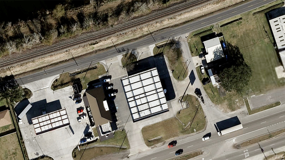
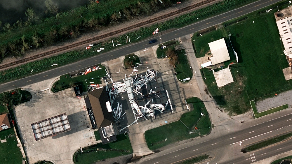
To get a better perspective of just how massive the scope of damage is, we’ve put together a small gallery of some of the hardest hit areas to help shed light on their current plight. In many images, it will be easy to see the destruction to home or buildings. But take a closer look and notice downed power lines, telephone lines, and road damage.
")