Latest Tips & Tricks in Viewer – Including Gray Sky Insights!
When disasters hit, such as wildfires, tornadoes, or hurricanes, we know that what you need quickly is high-resolution aerial imagery so you can quickly assess how your customers were impacted and to what degree. But we also have heard back from many members requesting additional ways of being able to know when Gray Sky imagery is available, or how to map it against your PIFs. Perhaps emails get missed but you’re jumping in Viewer to look up imagery and you wonder if there is Gray Sky imagery in that area.
We heard what you asked for and we’re happy to share a few new tips and tricks on how you can access or discover more about Gray Sky imagery within the Viewer platform.
Gray Sky Notifications in Viewer
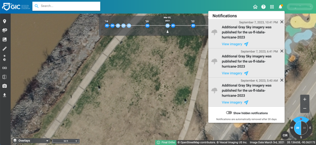
Did you know you can actually receive notifications within Viewer when Gray Sky imagery is available within certain areas? It might have gone unnoticed because it was a quick and subtle update we made, but one we knew that our members had asked as a small feature enhancement. And now not only can you see if new Gray Sky imagery was published for a recent event, you can actually click on the blue link directly below and be taken to the available imagery instantly!
Get Insights on Thousands of PIFs All at Once
Not too long ago, you might remember we shared details around importing your PIF CSV file with latitude and longitude information in Viewer to quickly pull up and discover if you have any properties that suffered damage following a major event where we collected Gray Sky imagery. It was a quick and easy way to you to discover and sort your results to see the hardest hit homes first. But next we’re also going to show you how you can also use this information to find other results and sort by property features.
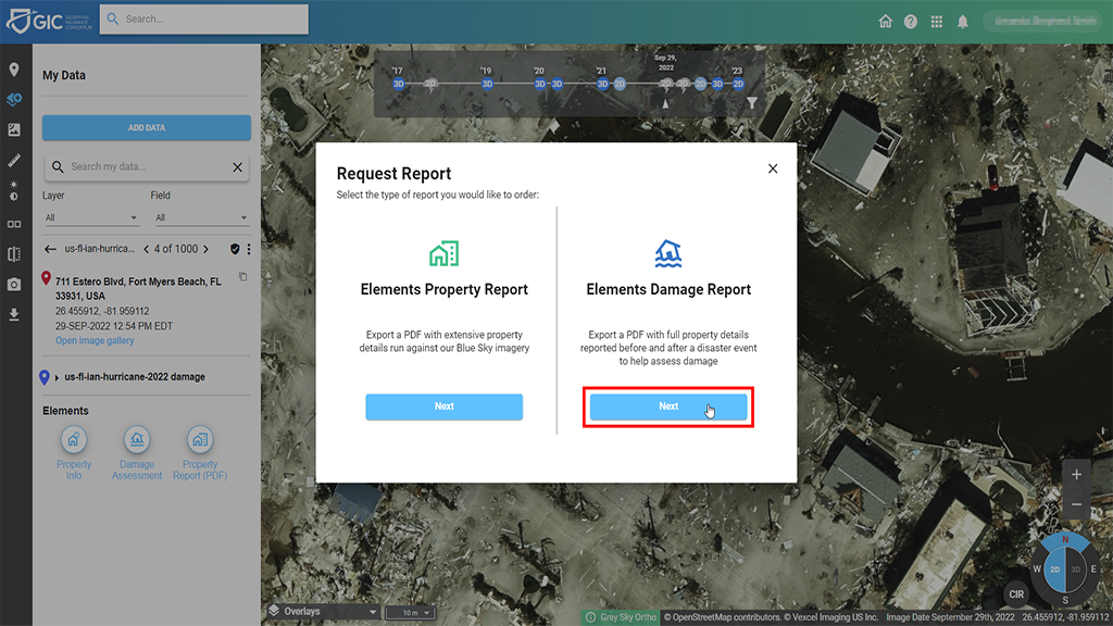
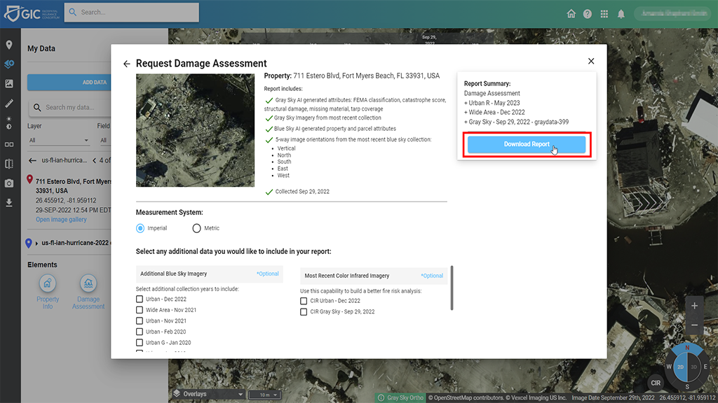
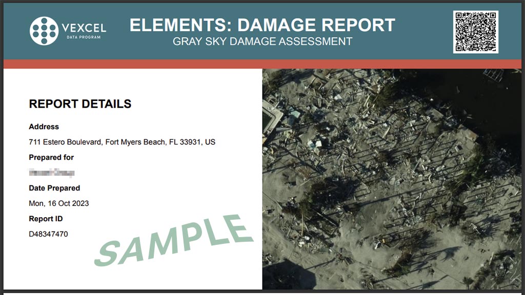
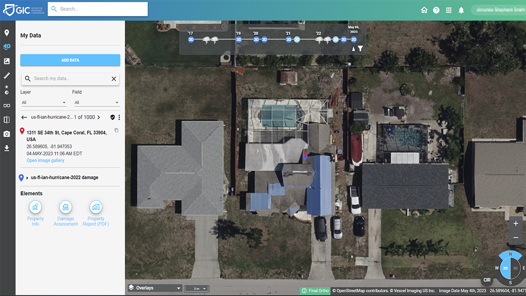
First, as quick overview, when you find a damaged property in the GIC Viewer, you always have the option to download a full Elements Damage Report. This PDF is exported with a multitude of information that you can select from, including previous collections, whether you need Multispectral (Color-infrared) imagery)–everything you might need and use to help you rapidly assess damage in great detail on a property. The end result? A multi-page report with valuable details on the damage to the home, with pre- and post-event imagery.
If you note on the screen above, this isn’t just available for the most highly damaged homes; it’s available for homes that suffered any damage at all under FEMA’s scoring guidelines. You can see in the screenshot above, that that this particular home was number 4 of 1000 pulled from the CSV used in the example from the previous blog post. And you could keep scrolling, keep selecting report after report, for every home you would need. No need to re-upload data for every PIF; it’s right there at your fingertips! Just keep scrolling to see each property, one by one.
Next Level Property Details – PIF X
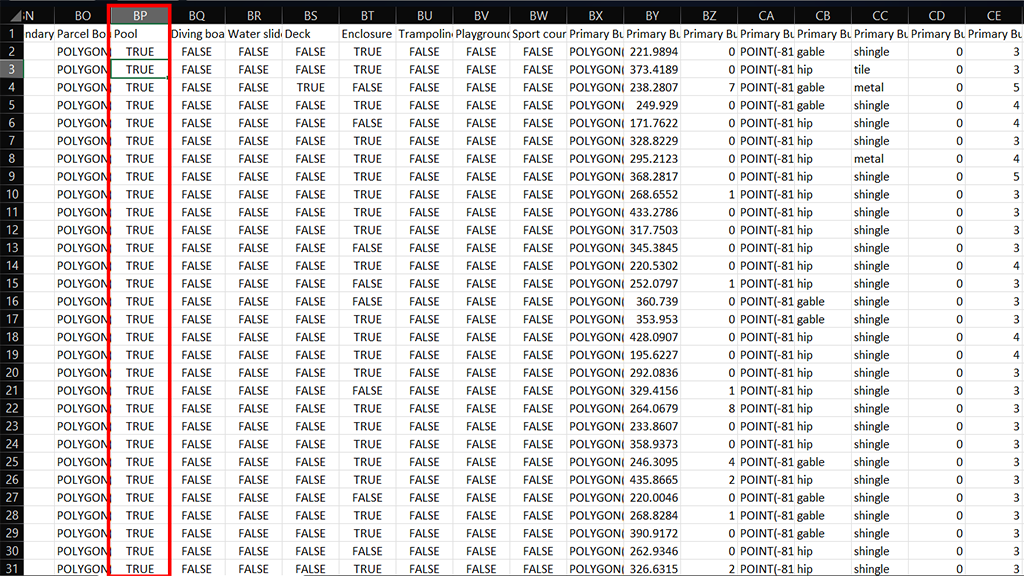
Now that you’ve pulled all the damage information and you still have your CSV file created and ready to go, did you know that you can also use that very same list to extract other property features and continue to pull Property Reports one right after another? Take your CSV file you used previously and sort it based on the property features you are interested in. For this example, we were looking for homes in this area with pools so that value would show as TRUE in the column.
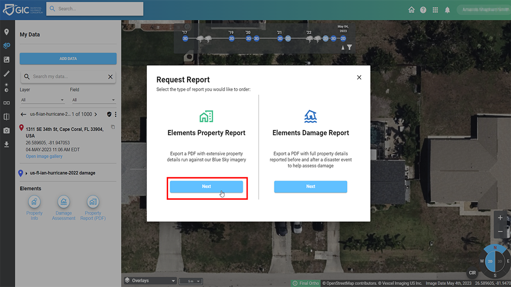
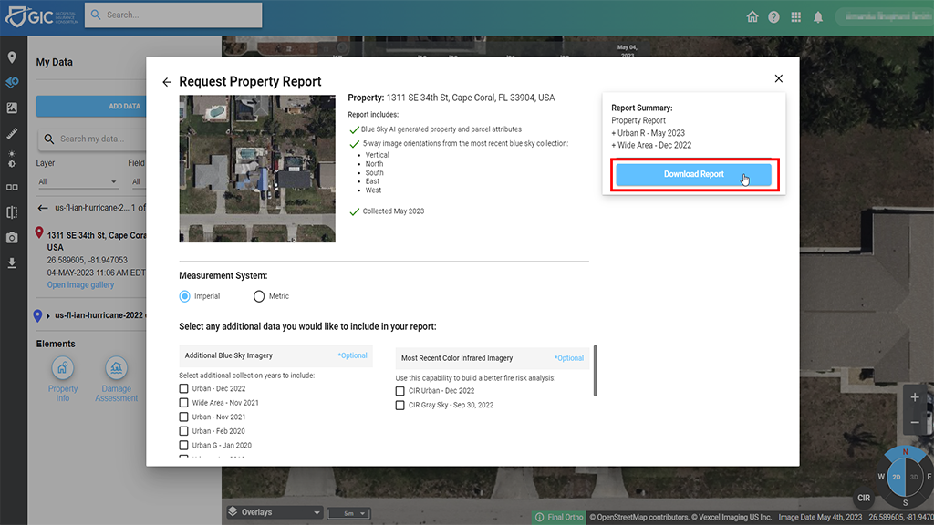
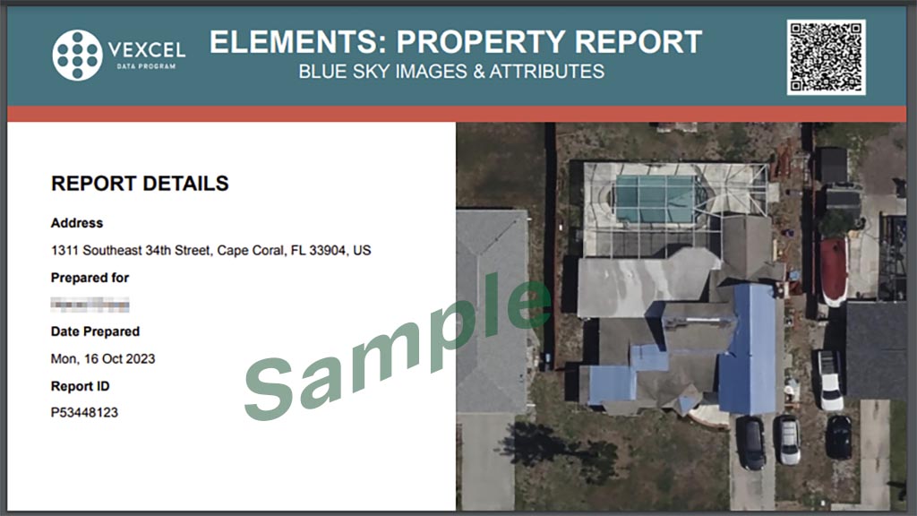
Pulling this type of property information is typically called the PIF x Property Information Tool, where you can sort by the features you’re interested in discovering on all your properties. So now we have the first home of 1000 homes that popped up with a pool identified on it. Select the Elements Property Report which focuses on the Blue Sky imagery. Next, you get to select the many types of imagery available and then submit your request. Within seconds, you’ll have a full multi-page PDF report highlight over 40 different key building and property features on this home. Again, no need to keep re-uploading homes individually to get this information; it’s there right in front of you at the click of a button.
Again, once you have your CSV file loaded into Viewer, pulling this valuable data on every property only takes just a few seconds, whether your file contains a few hundred homes or several thousand. Want to learn more or connect with one of our Customer Advocates to get started using this data for your book of business? Connect with us today through our Support team.

