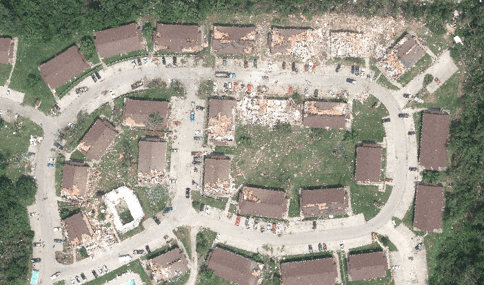
Imagery for Jefferson City, MO tornado available to GIC Members and Public Safety Stakeholders
Today we published imagery collected on 24-May for the tornado that struck Jefferson City, Missouri. 7 cm resolution images were collected over areas of the city and are now available via secure web maps and services available at http://maps.geointel.org. If you have any questions please reach out to us at graysky@geointel.org. Credentials for public safety stakeholders to access the data may be requested at credentials@geointel.org.