Gray Sky Event: Tornado Strikes Norman, Oklahoma

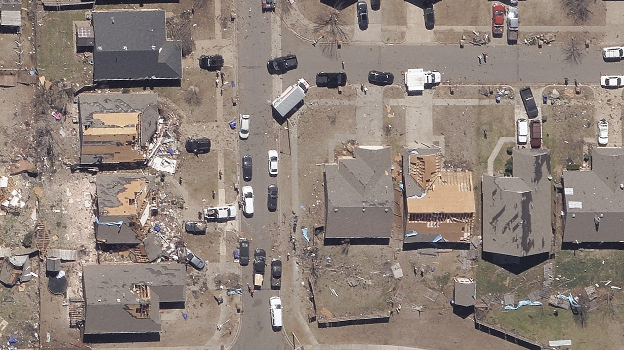
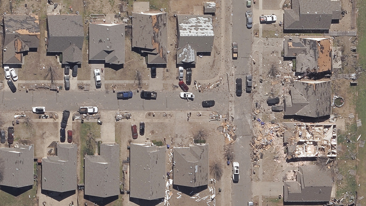
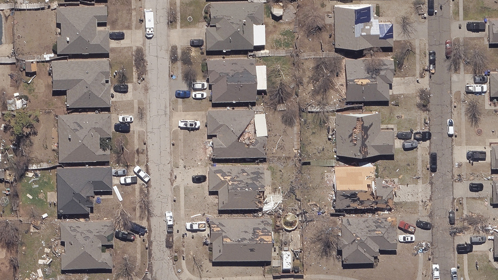
Severe storms moved across the Texas Panhandle and Oklahoma on Sunday night. The storm produced high winds and an EF-2 tornado hit near Norman, Oklahoma. Homes, businesses, and schools were damaged in the third largest city in the state about 20 miles south of Oklahoma City. The GIC, along with its operations partner Vexcel, quickly activated and assigned a fixed-wing aircraft to collect high-resolution aerial imagery of the tornado-damaged properties on Monday. The collection included the highest impact areas and followed the tornado’s path northeast.
Ortho imagery was published at 10cm and made available to GIC members and partners late Monday night. This detailed imagery shows the extensive structure and roof damage to properties in the tornado’s track. Aerial imagery is now available in GIC platforms, including GIC Viewer, APIs, Image Services for ArcGIS, and select partner platforms.
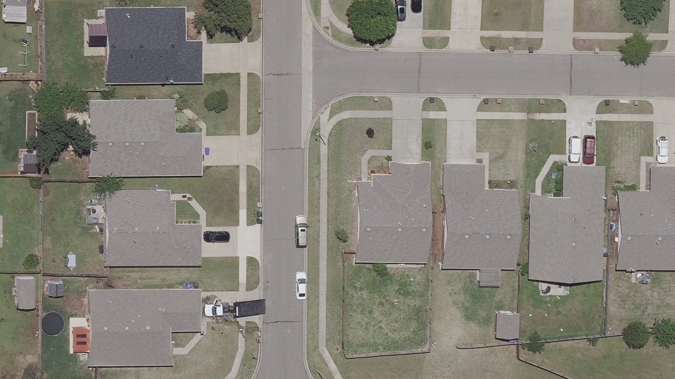
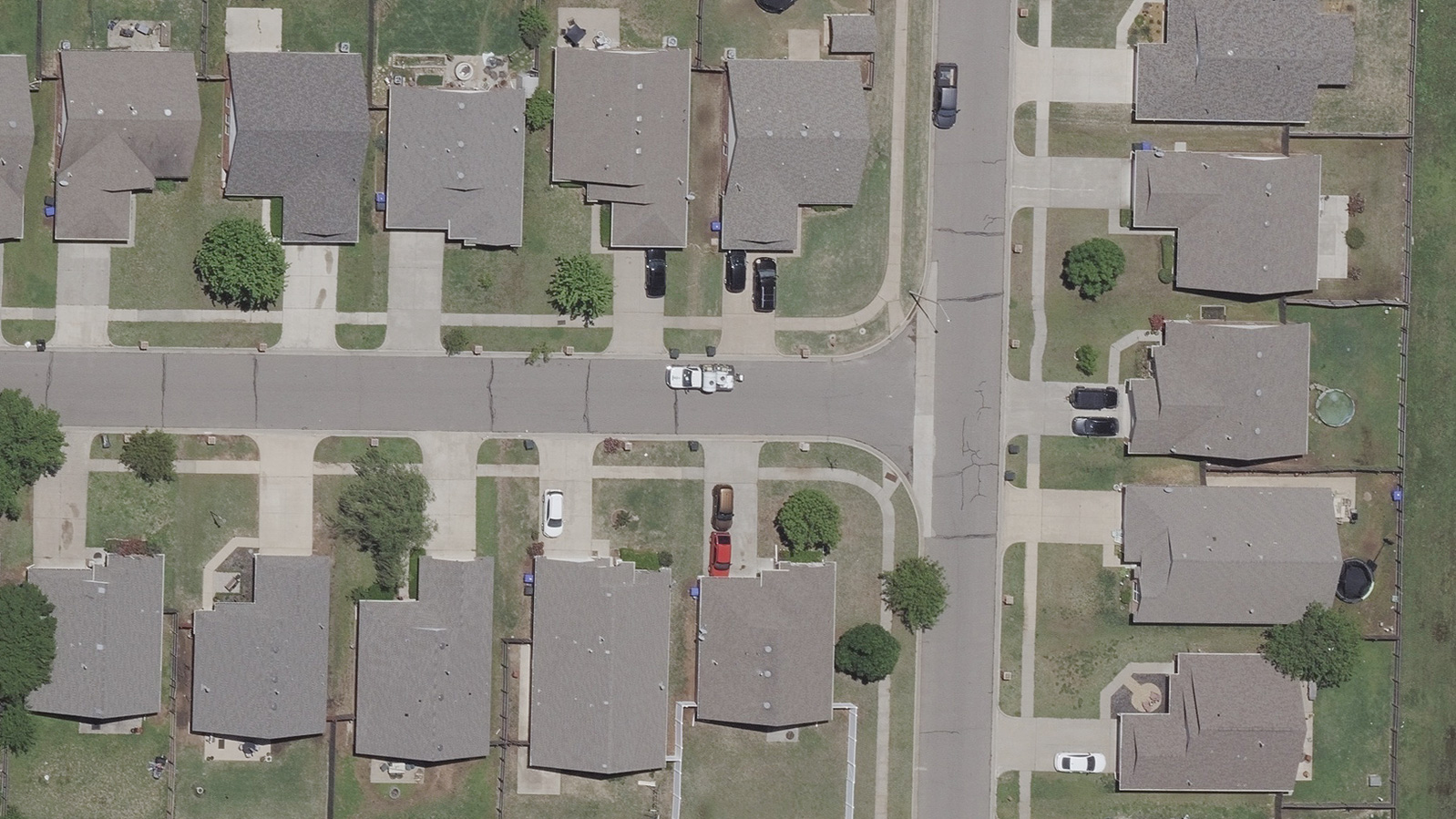
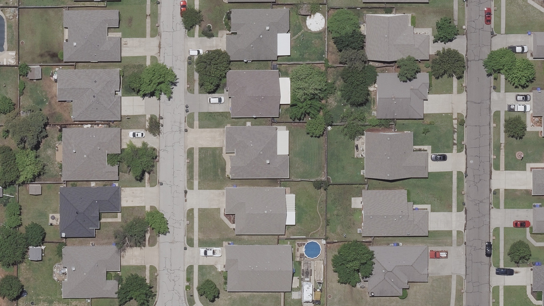
The GIC also has before images Norman area to better inform insurers with remote assessment and triage teams on the ground. Our thoughts are with the Norman community and emergency responders as the respond and start to rebuild. If you need access to imagery, please contact us below.
Here’s a handful of images from yesterday’s collection: