Gray Sky Event: Texas Fires
March 1, 2024 —
Fueled by high winds and dry conditions, wildfires in the Texas Panhandle have spread across more than 1 million acres this week. Our Gray Sky team actively monitored the fires and collected feedback from GIC members. And, on Friday morning, the team mobilized a flight crew based out of Lubbock, Texas, to capture six areas within the Windy Deuce and Smokehouse Creek Fire Zones. These areas, totaling 73 square miles (191 km²), were selected for their higher population density and member interest, including Fritch, Borger, Canadian, Miami, Stinnett, and Skellytown.
Same-Day Delivery
In collaboration with its operations partner, Vexcel, the GIC quickly processed and released orthomosaic and color-infrared aerial imagery by late Friday night. Imagery at a 10cm resolution is now accessible to GIC members and partners through the GIC Viewer, APIs, Image Services for ArcGIS, and supporting platforms.
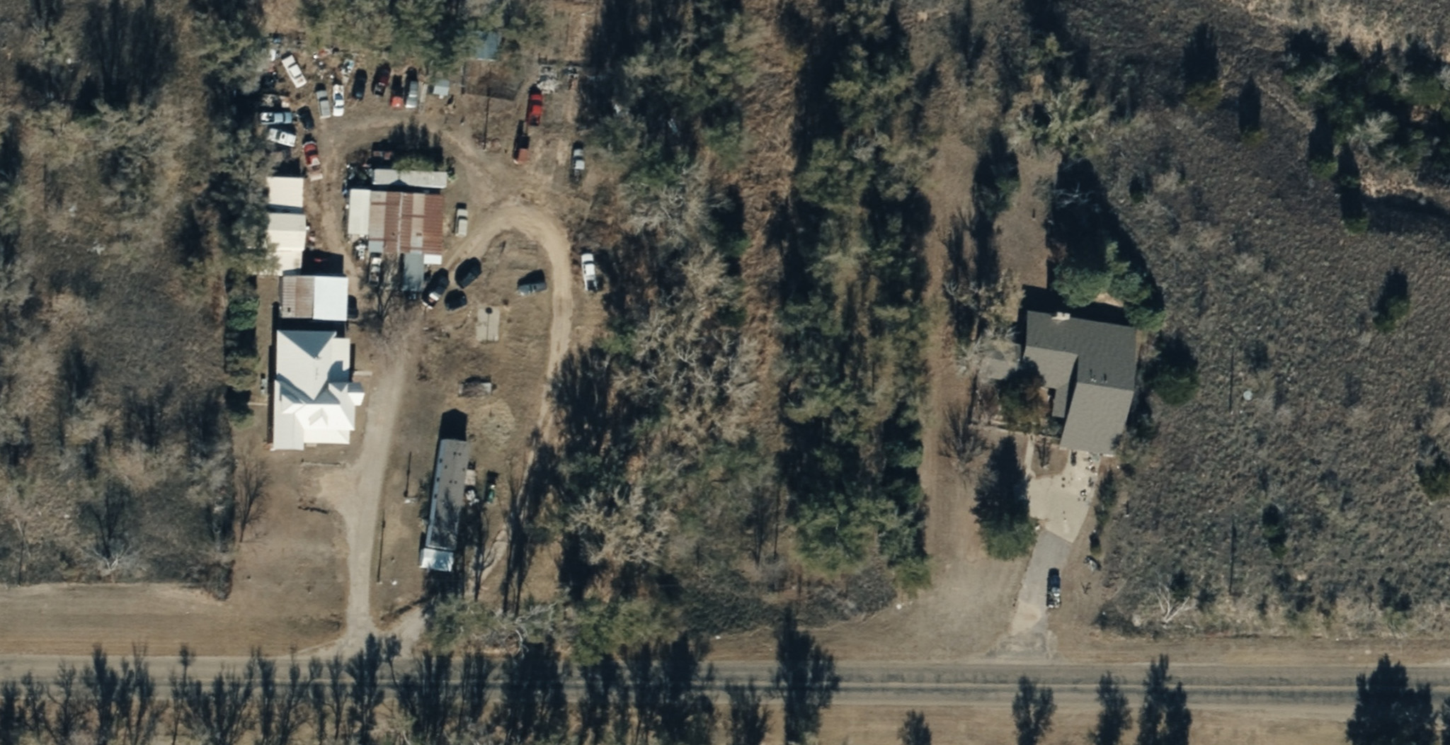
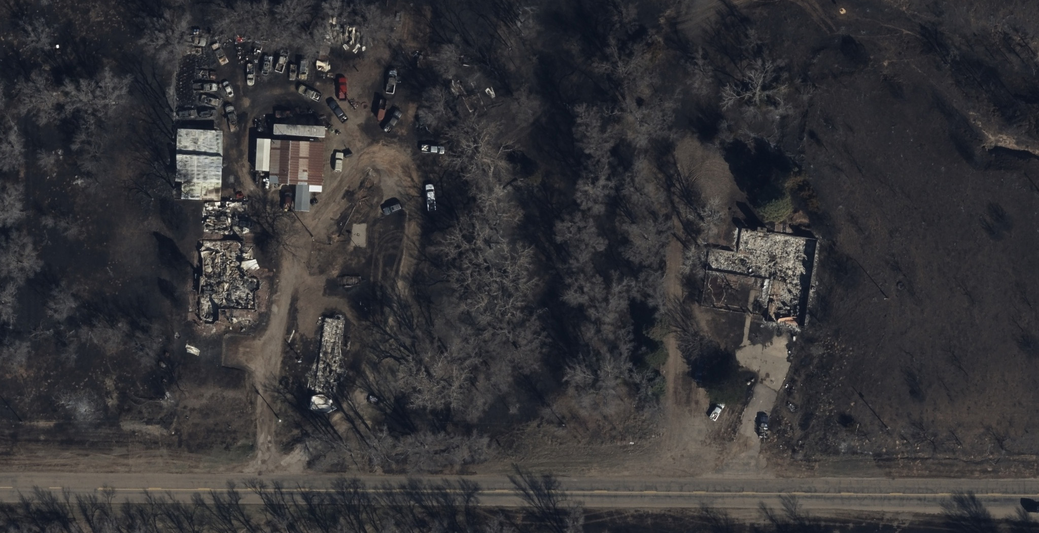
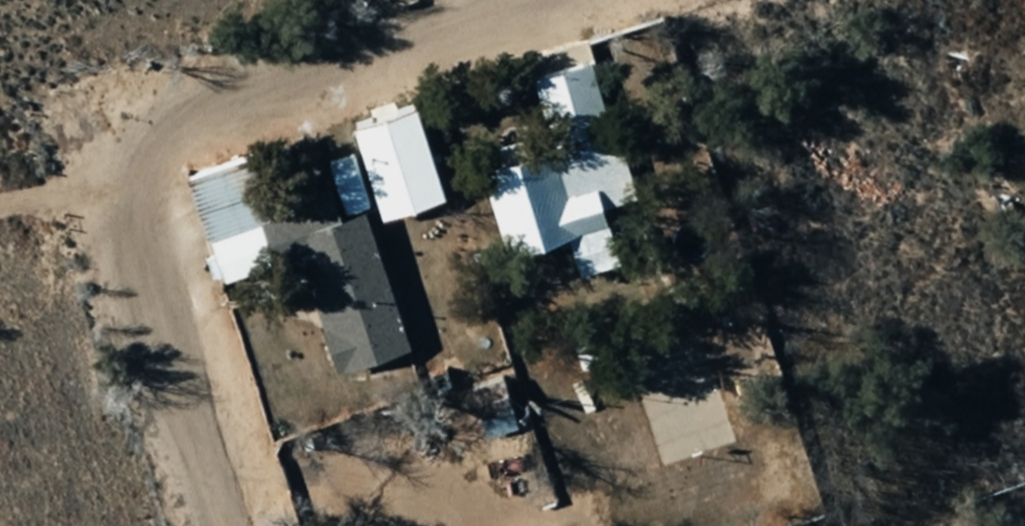
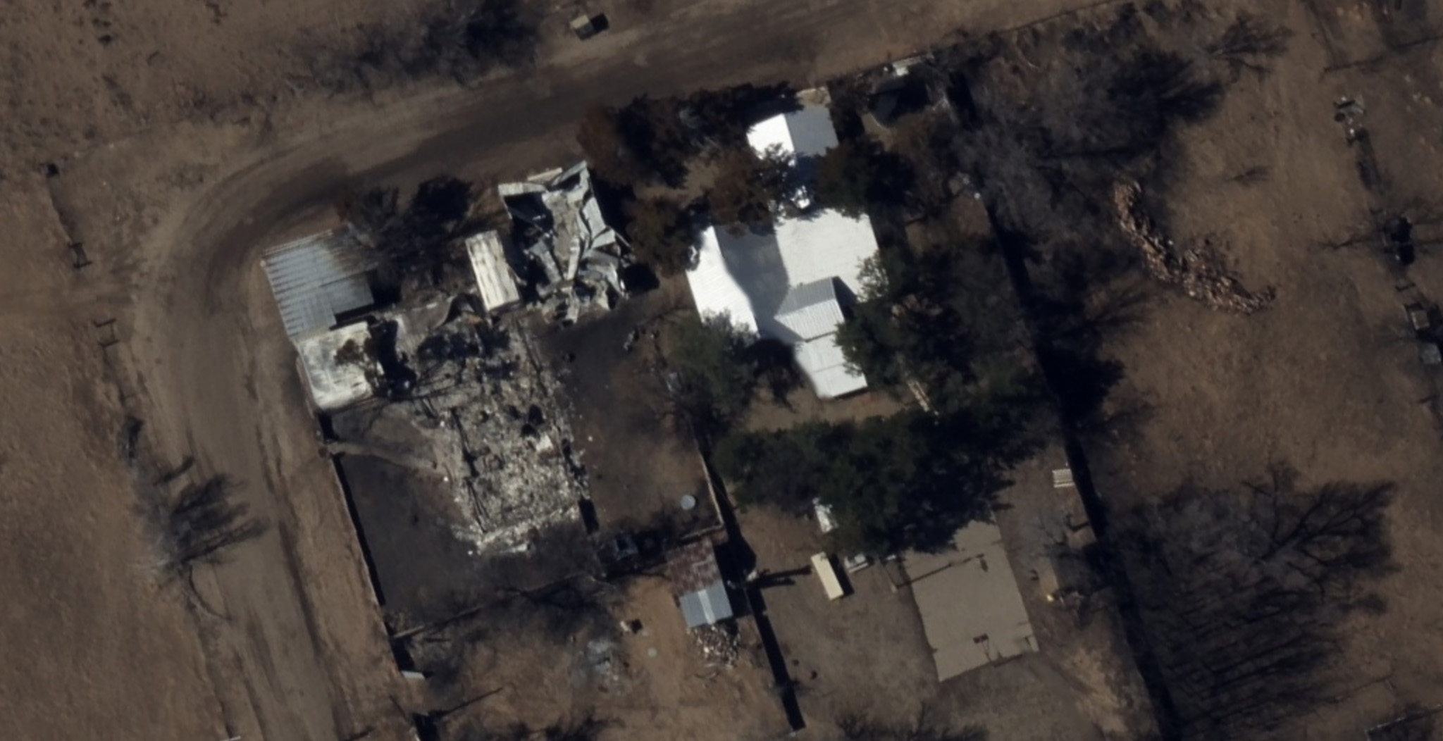
Below are select images from the collection:


Utilize Historic Imagery to Gauge Scale of Damage
We also provide access to historic imagery collected in 2022 and 2020. These images facilitate before-and-after comparisons, providing a clearer understanding of the extent of damage in the affected communities.
High-Quality Imagery for Damage Assessment
In wildfire burn zones, the landscape can appear chaotic, with burned homes standing next to untouched ones. On Saturday morning, the GIC published AI-derived Damage Assessments. This data enables emergency managers and insurers to remotely assess property damage, even in areas still inaccessible to residents and field adjusters. An overall post-CAT score is provided for each property. This information aids in directing resources where they are most needed.