Gray Sky Event: Hurricane Milton


Hurricane Milton Overview
Our multi-day, wide-scale aerial imagery collection will cover nearly 20% of Florida in the aftermath of Hurricane Milton and corresponding tornadoes. The collection includes high-resolution ortho and multispectral imagery in all areas, with oblique imagery available in select locations.
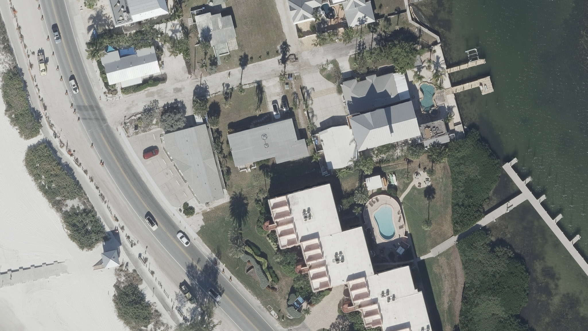
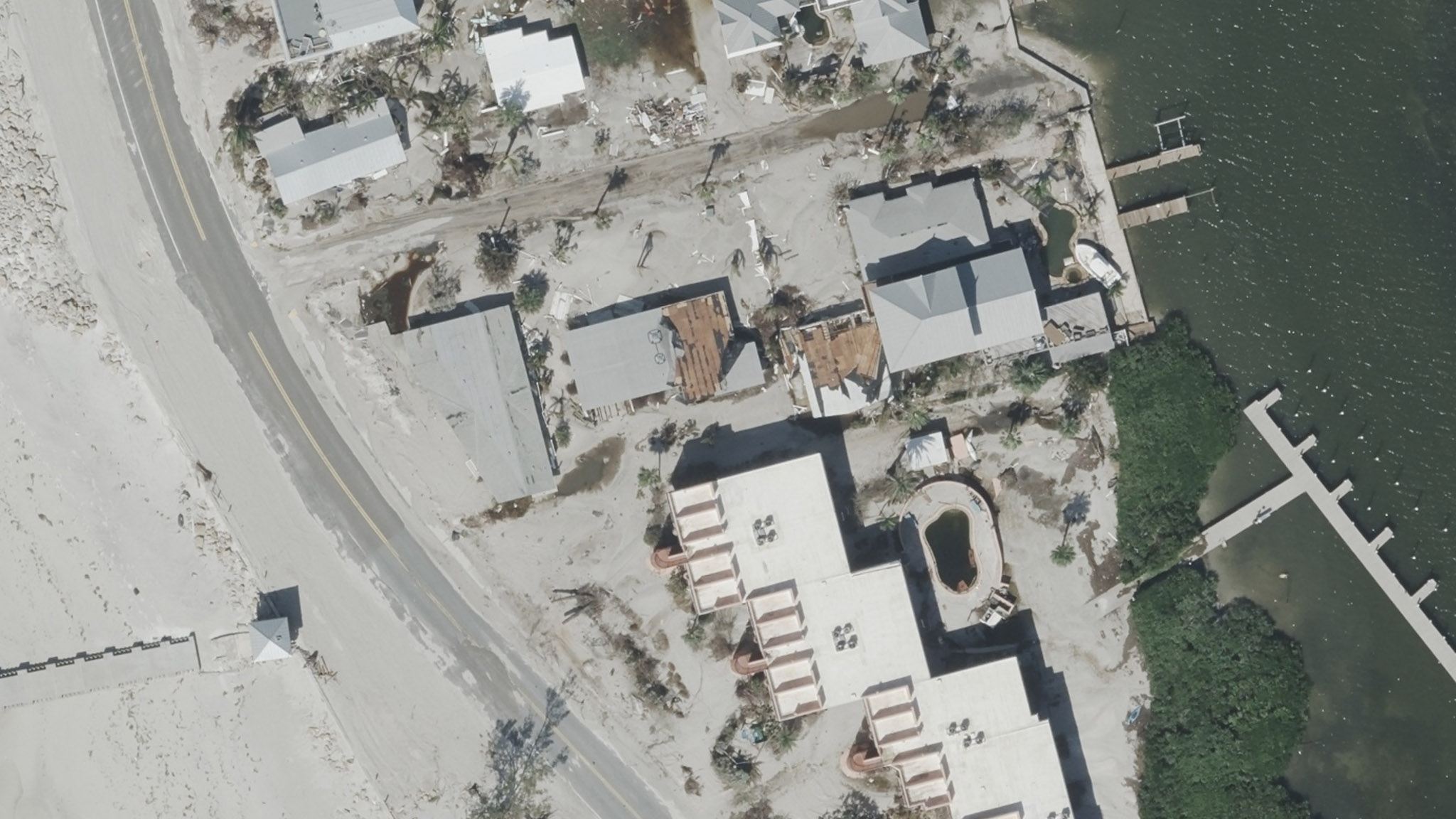
Every property in our Milton Gray Sky collection will feature a full damage assessment, along with before imagery for comparison to assess the storm’s widespread impact.
If you need access to imagery for your recovery and rebuilding efforts, please contact us.
More Imagery Collected & Published
Sunday, October 13
Lots of high-resolution aerial imagery and damage assessments continue to roll out on the Vexcel Platform and select partner sites. Our Gray Sky team remains dedicated to supporting customers, partners, and state and emergency agencies.
")

")


Sunday’s Aerial Collections
Aircraft crews were up early Sunday and had a few hours of aerial collection before weather conditions impacted flight operations. We will extend our multi-day, wide-scale collection following the aftermath of Hurricane Milton.
Additional Imagery Published
Saturday, October 12
As we continue our multi-day collection across areas of Florida hit by Hurricane Milton, we’re rolling out more published imagery day-by-day. The latest areas published to our Viewer platform and available via select partners include: St. Petersburg, Largo, Tampa, Siesta Key, Longboat Key, Anna Maria Island, Sarasota, Clearwater, and Homosassa Springs. Many of these areas include high-resolution oblique images as well. View additional imagery in the gallery below.


More Imagery Published
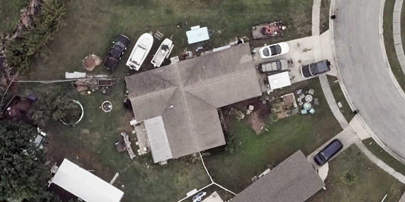
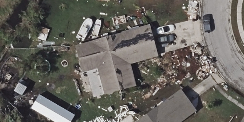
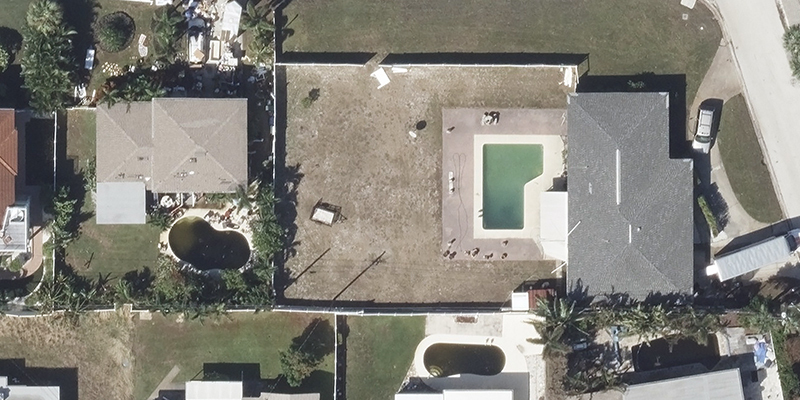
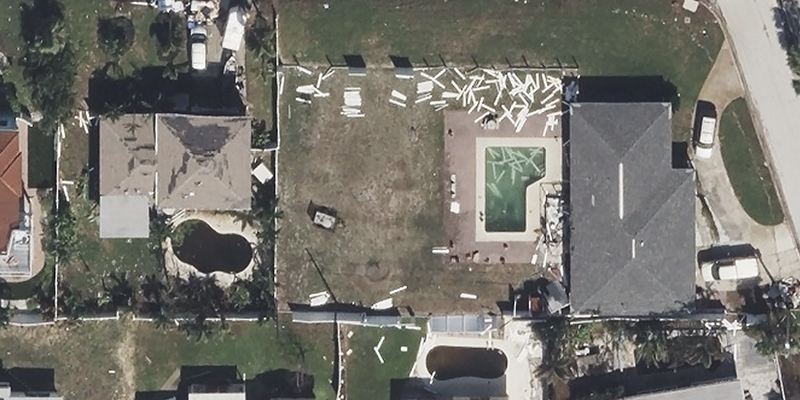
Friday, October 11
More high-resolution aerial imagery is now available in select areas impacted by Hurricane Milton. You can compare before and after images and soon see full property damage reports. Here are some before-after images from St. Petersburg and Palmetto, Florida.