GIS for Disaster Response
This past weekend officially marked the start of the Atlantic 2019 hurricane season. As we look to the future, new strategies and capabilities are needed to better mitigate, prepare, respond, and recover from these devastating events.
This past year, the United States saw unparalleled devastation. Major events included catastrophic wildfires in California and two of the strongest hurricanes to hit the United States in decades.
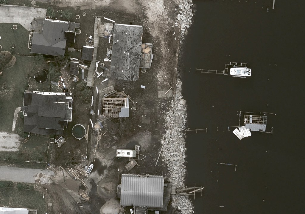
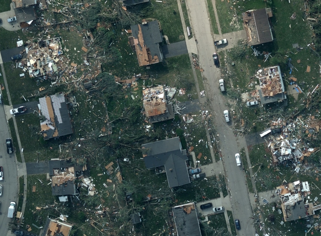
In September 2018, Hurricane Florence struck the coastline of North Carolina and brought record flooding, dangerously high winds, and a hazardous storm surge. Reports estimate $17 billion in total damage across the state.
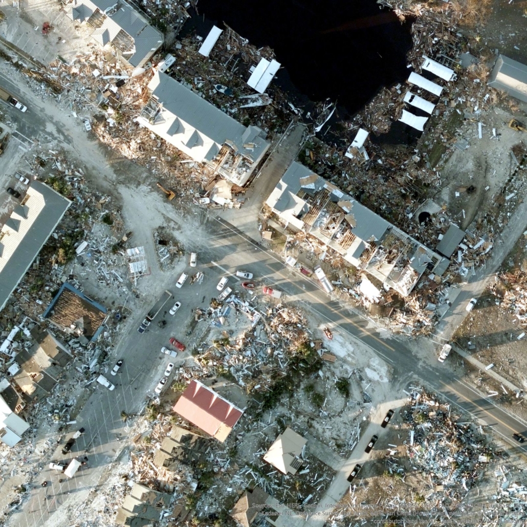
The following month, Hurricane Michael, hit Florida. It was recorded as the strongest storm to ever hit the panhandle, initially classified as a Category 4 hurricane and later re-classified as Category 5, making it the fourth strongest storm in US history.
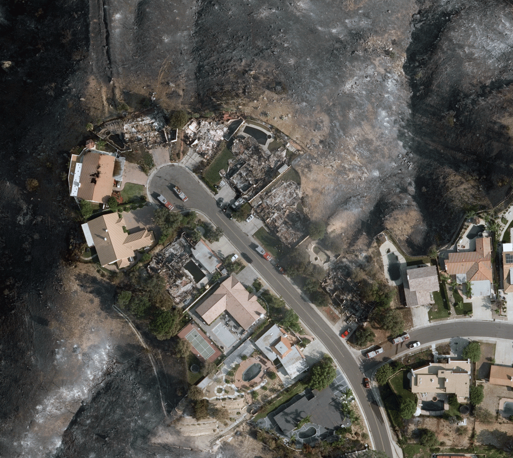
Then November came with massive wildfires which broke out throughout the state of California. The northern fire, Camp Fire, became the deadliest and most destructive wildfire in California’s history. Current Cal Fire reports document 89 fatalities and over 18,000 structures destroyed.
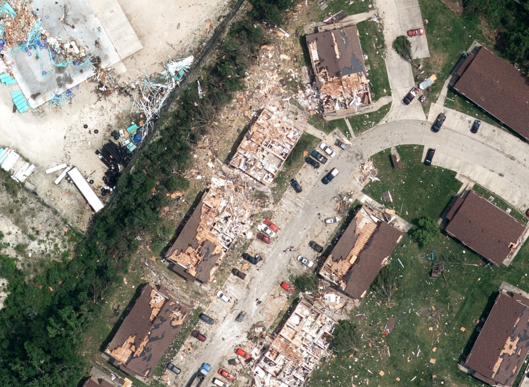
Hail, tornadoes, droughts, and other severe weather storms ravaged different parts of the nation adding up to 14 major events in 2018 and an estimated cost of $91 billion for the US as a whole.
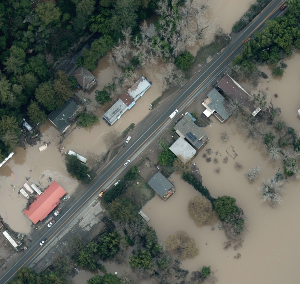
Already in 2019, disasters have affected many parts of the country. The Geospatial Intelligence Center (GIC) has responded to 7 disaster events in 2019 including floods in Sonoma County, California; hail storms in Collin County, Texas, and Raleigh, North Carolina; and tornadoes in Lee County, Alabama; Ruston, Louisiana; Jefferson City, Missouri; and Dayton, Ohio.
Though trends indicate there will be an increase in the number of disasters in our future, new technological advancements can help combat the severity of damage associated with these events. One of these technological categories is GIS.
Curious how?
In this blog series, we interview GIS and emergency management expert, Richard Butergerit, on the use of GIS technologies to improve catastrophe response.
A little bit about Richard…

Richard spent 12 years at the Florida Division of Emergency Management (FDEM), where he served as the Chief Information Officer for the Division and Technical Services Branch Chief for the Florida State Emergency Response Team (SERT).
At FDEM, he provided information to facilitate decision makers, sustained information technology and information management for emergency planning, mitigation, response, and recovery to the Division and the State Emergency Response Team.
After working with the Geospatial Intelligence Center (GIC) during Hurricane Michael to help facilitate geospatial imagery and data to the public sector, he saw the impact the GIC initiative could have on a large scale. Richard joined the GIC team as the Director of Catastrophe Response in November 2018 and now is leading response efforts to continue to transform how both private and public organizations combat the severity of these disaster events.
Q&A:What attracted you to a career path in GIS?
“My first attraction to maps was volunteering with the Monteverde Conservation League and working with conservationist Wolf Guindon.
Before the days of GPS, we hiked in and around the Monteverde Cloud Forest Reserve, the Children’s Eternal Rain Forest and other conservation lands with a compass and some laminated topo maps.
I returned to the states, enrolled in college at New College in Sarasota, Florida, and began to work at Myakka River State Park with many mapping related projects. Conducting my thesis project at New College, I built a GIS before I ever really knew what a GIS was — using an early Macintosh graphics program called Canvas to create layers that could be turned on and off to visualize and manage the restoration of a coastal hammock on Longboat Key, Florida.
After graduation, I got hired as a biologist with the Florida Park Service and given ArcView 2.1 and a Trimble GPS backpack unit. I was hooked and soon on my way mapping everything I could.”
Though today’s world is challenged with an increase in the frequency and severity of natural disasters, GIS technologies have the power to better prepare and combat the severity of the event.

 Geospatial Insurance Consortium