[elements]
Property Attributes & Reports
Up level your underwriting and risk modeling using accurate, up-to-date property information in Australia, New Zealand, and the United States.
Instantly Access 40+ Attributes Per Property
Automated insights are instantly available when you make use of Property Attributes. By applying machine learning across our highly accurate and detailed database, multiple pieces of information on a property are readily available for members to view. Plus, when paired with our detailed aerial imagery, you can track change over time to better support underwriting, risk analysis, claims management, and fraud detection.
Best-in-class Imagery for Accurate Analysis
Your GIC membership gives you get access to a robust library of premium aerial imagery and geospatial data. When you add in Property Attributes, you get highly detailed information automatically populated across millions of residential properties. It’s machine learning at its best, applied against the GIC’s consistently accurate, high-resolution aerial imagery and geospatial data.
Valuable Property Insights in Seconds
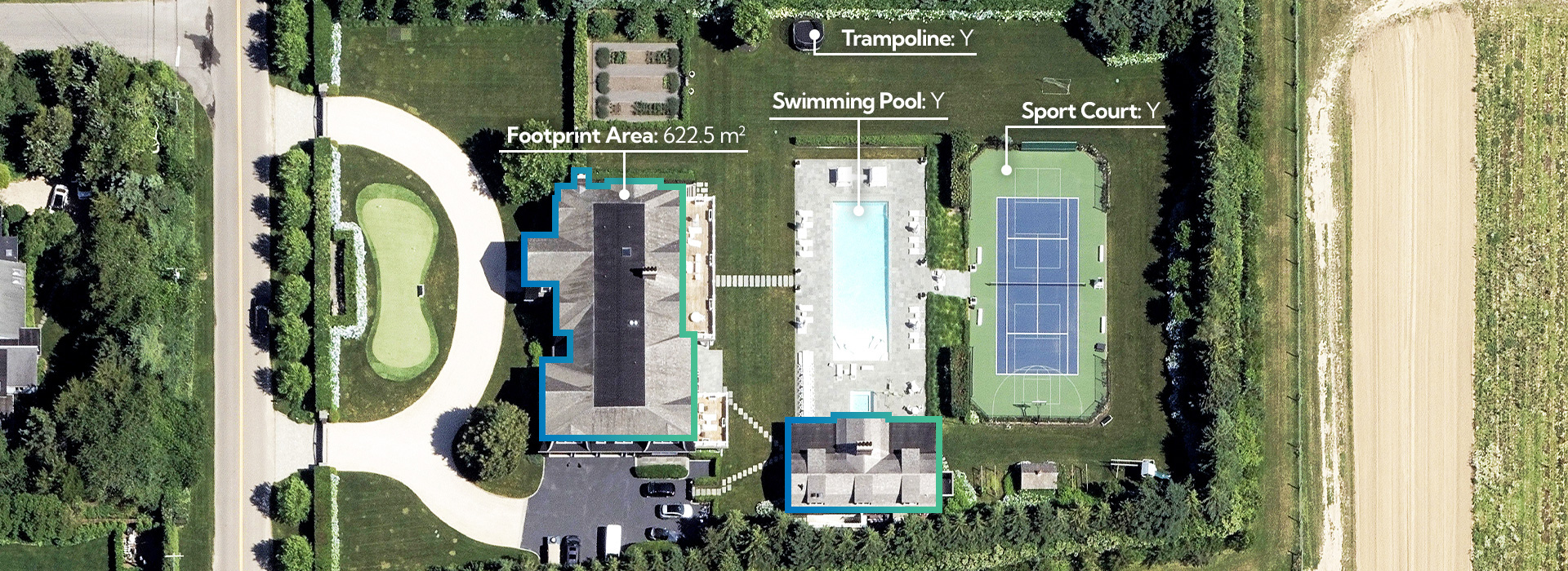
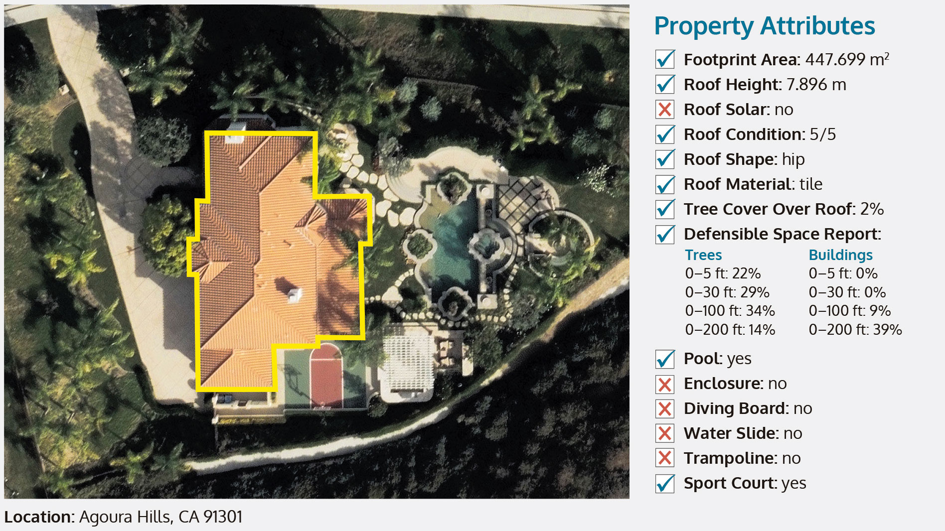
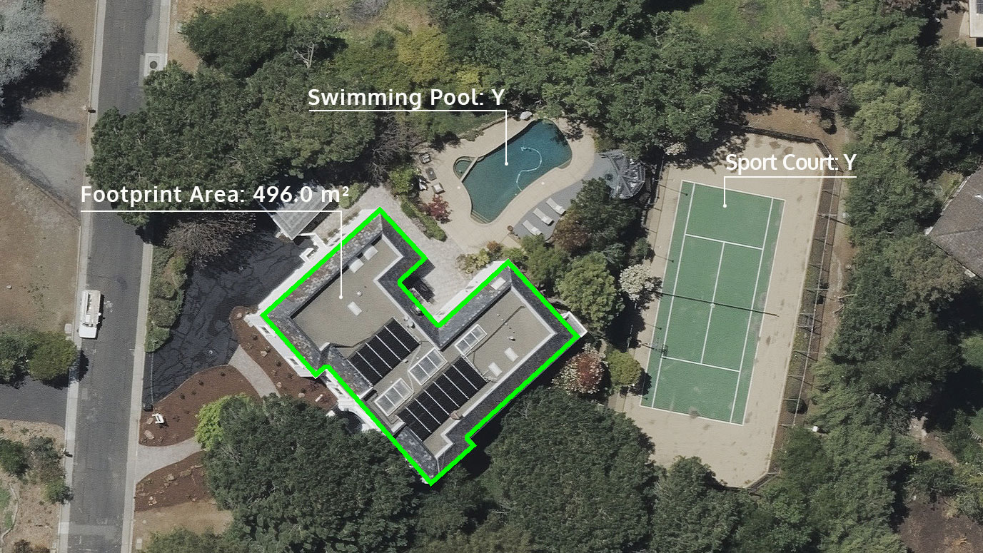
Starting with location coordinates, your team can remotely view vital property facts such as roof condition, building outlines, and whether the property has a deck, pool, solar panels and more. Use this data to perform faster underwriting analysis, improve your carrier quoting, and modernize your renewal inspections. It is instant, actionable property features without ever setting a foot on the ground.
40+ Property Attributes
Property Attributes is just one of four Elements products currently available. It helps insurers go beyond visual confirmation of the details of a property and provides an algorithmic way to validate additional information.
- Footprint polygon
- Footprint area
- Ground elevation
- ROOF FEATURES
- Roof elevation
- Roof height
- Roof condition
- Roof centroid location
- Roof material
- Roof shape
- Roof solar
- ROOF DISCOLORATION
- Algae staining
- Vent staining
- Water pooling
- ROOF ELEMENTS
- Tree cover over roof
- Air conditioning units
- Chimneys
- Roof vents
- Satellite dish
- Skylight
- DEFENSIBLE SPACE REPORT
- Trees: 5, 30, 100, 200 ft
- Buildings: 5, 30, 100, 200 ft
- PROPERTY FEATURES
- Primary structure
- Parcel geometry
- Playground
- Sports court
- Trampoline
- Enclosure
- Hardscapes: Detected
- Hardscapes: Area
- Deck: Detected
- Deck: Area
- Pool: Detected
- Pool: Type
- Pool: Surface Area
- Water slide
- Diving board
- Vehicles: Automobiles
- Vehicles: Boats
- Parcel tree cover
- Coverage: Property Attributes
- Delivery methods: GIC Viewer, GIC APIs, Select GIC Partners, PDF Reports
Drive Innovation Across Your Organization
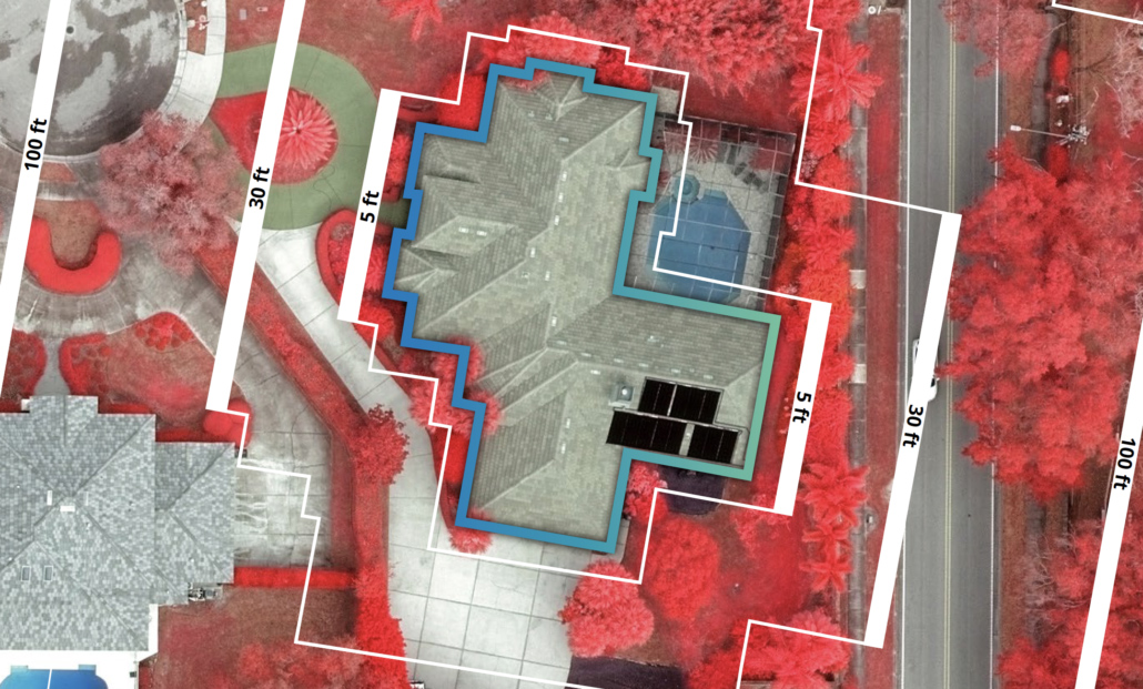
Use Property Attributes on Multispectral imagery to discern key pieces of property information, helping you proactively reach out to customers before a small issue becomes a major problem. It can also help you make sure your policies are compliant with the latest state laws for defensible space. Identify any changes that raise red flags and impact property value and insurance coverage rates. Point out dead vegetation, dying trees, or roof concerns needing to be addressed by a customer. Property Attributes, when paired with high-res imagery, help you ensure your customers are adequately covered. Getting quick access to property-level features helps better support your decision-making, from one end of the policy life cycle to the other.
Download A Property Report
See current property insights derived from high-res aerial imagery, all packaged into a comprehensive PDF report.
Request A Demo
Unlock more insights for insurance.

