Central Insurance Companies Joins GIC Program to Help Combat Fraud Remotely
The Central Insurance Companies has joined the Geospatial Intelligence Center program (GIC), an insurance industry consortium spearheaded by the National Insurance Crime Bureau (NICB), to help combat fraud using advanced aerial imagery.
“Insurers are always looking to adapt to change, and the GIC showcases how the industry is ready to help policyholders by allowing adjusters to handle claims remotely,” said Central’s Vice President of Claims Paul Edwards. “In this current climate, it’s essential to keep our customers safe, but still assist in the aftermath of catastrophe.”
“This advanced imagery allows our fraud investigators to conduct an investigation remotely; without GIC imagery, that would not be possible,” said Central’s Director of Anti-Fraud & Recovery Jeff Lieberman.
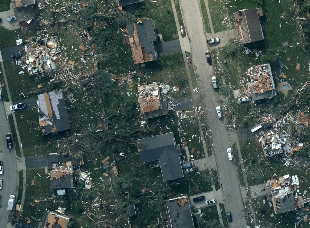
As the GIC’s newest member, Central now has access to advanced aerial imagery and detailed property data to better serve its policyholders. Amidst the COVID-19 pandemic, the ability to maintain business continuity is a crucial goal for insurance carriers like Central Insurance. Geospatial data from GIC provides additional resources to be used by desk adjusters and reduces the need for on-site visits by allowing field teams to conduct remote inspections using ultra-high-resolution imagery.
“Having access to the value proposition offered by the GIC program is especially important as companies face the challenges presented by the COVID-19 pandemic. Central recognizes the value and efficiencies that are achieved by having the GIC’s high-resolution imagery available with a click of a button on the desktops of their claims team,” said NICB Chief Operating Officer Jim Schweitzer.
Within the first several hours or days following a major disaster, the GIC fleet of fixed-wing aircraft will fly over impacted areas to capture and assess damage to provide members with unprecedented ultra-high-resolution imagery and data on affected properties. The NICB, working with law enforcement and disaster scene commanders, has provided the GIC program with access to disaster areas as soon as it is safe to fly. The GIC program provides imagery and data to members within 24–36 hours of the aircraft touching down.


 Geospatial Insurance Consortium