Marshall Fire Destroys Nearly 1,000 Homes in Boulder County, Colorado
High-resolution aerial imagery now available for fire-damaged homes and buildings in Superior and Louisville.

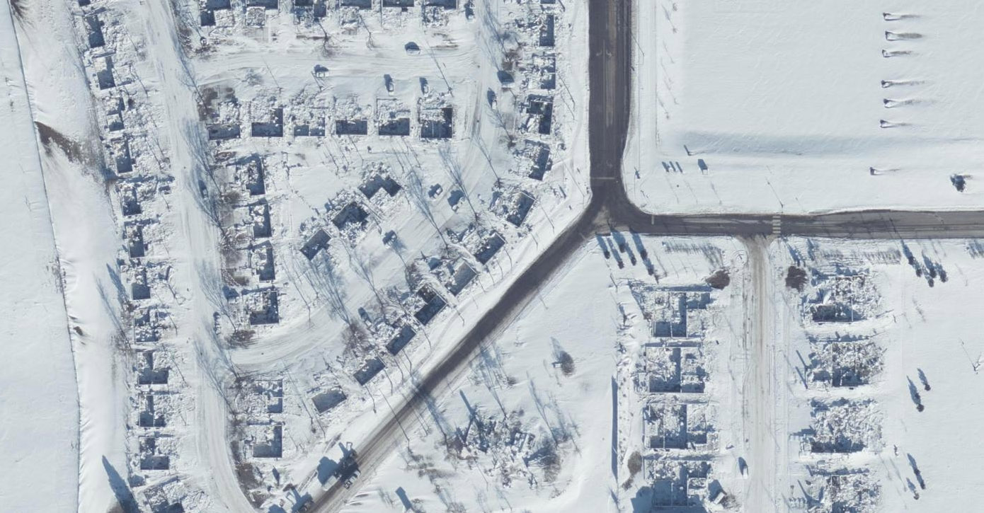
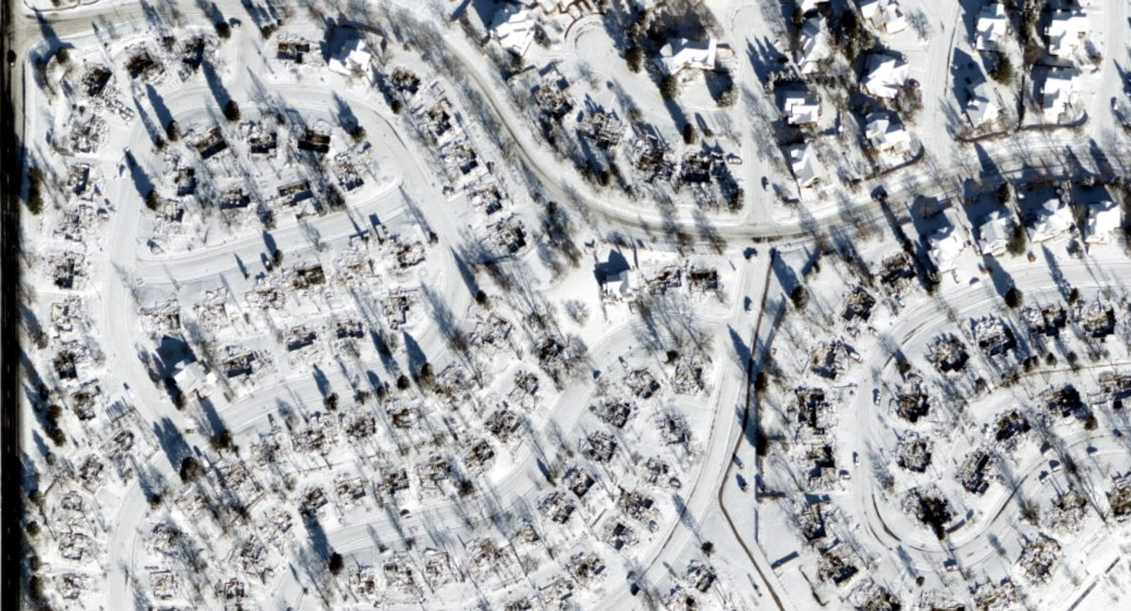
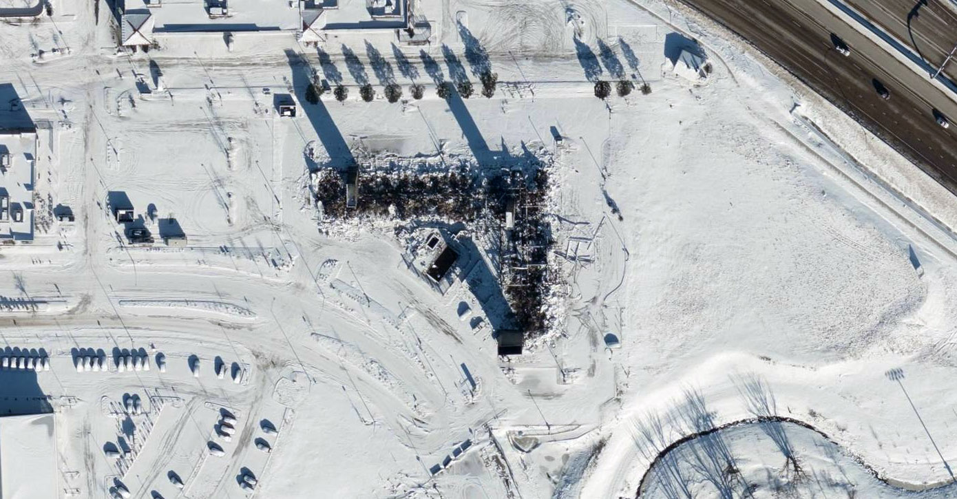
Officials call it the “most destructive fire” in Colorado history. And early estimates of property damages are north of $1 billion. On December 30, the Marshall Fire swept through two Boulder County, Colorado communities, Superior and Louisville, destroying a current count of 991 homes and damaging 127.
The GIC monitored, activated, and collected high-resolution aerial imagery of this Gray Sky event on the behalf of its insurance members. Ortho imagery is now available in the GIC Viewer and via our map services. If you need access to this post-cat imagery, please fill out the form below.
The cause of the late-December fire is still being investigated by Boulder County officials. But once the blaze started, winds fanned the fire with gusts up to 100 mph. Within hours, a firestorm quickly moved through neighborhoods, across roads and open park spaces and into more Boulder suburbs. The fire burned throughout the afternoon and into early morning of New Years Eve before it was contained to an area. Then a winter storm dropped 3-5 inches of snow, helping smother the flames more.
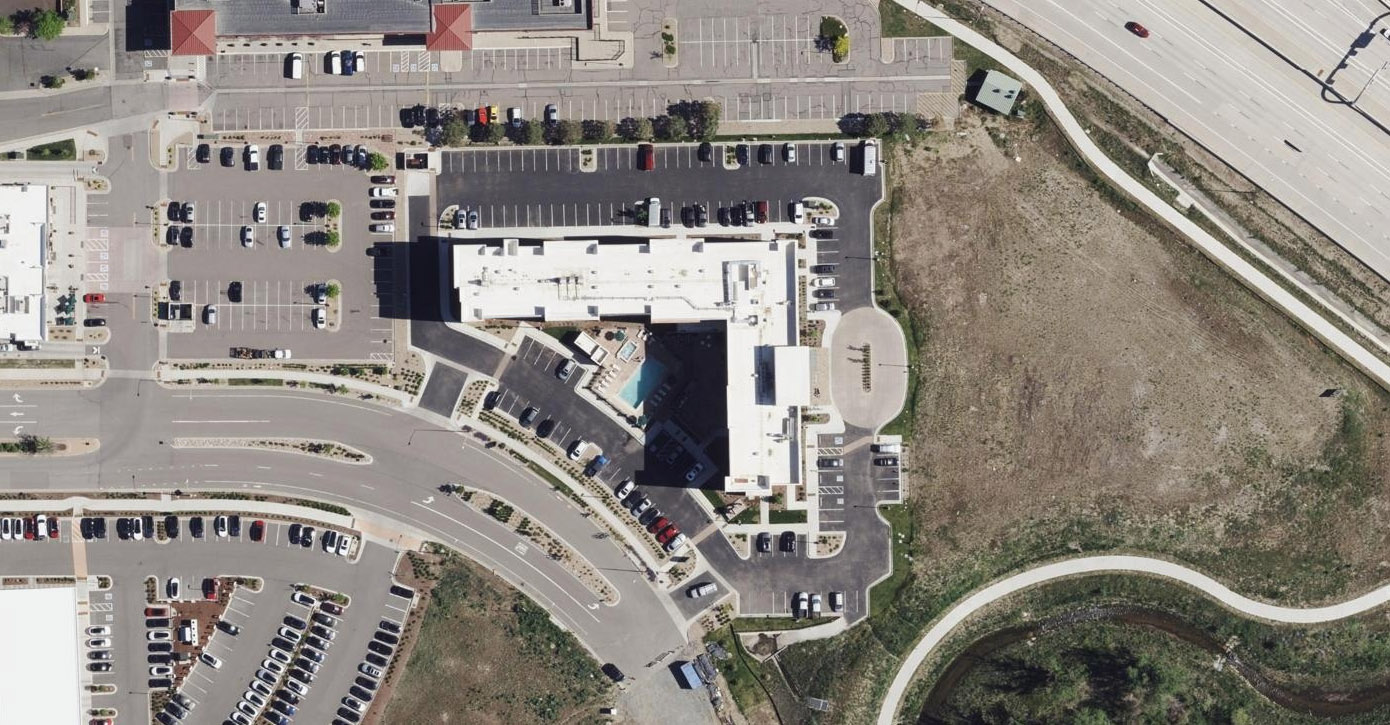
This disaster likely breaks a Colorado record for fire damage to insured properties. According to Realtor.com, the medium home value in the Superior area is $775,000 and $885,000 in Louisville. Several commercial buildings were burned or damaged too, including a Target and Costco. Residual smoke damage to buildings could drive losses up more.
Disaster In Our Backyard
This fire hits close to home for some of our staff at the GIC and our operations partner, Vexcel. The blaze was only a few miles from our Broomfield office. And, some staff members found themselves having to evacuate their homes with little notice and others were on high-alert in pre-evacuation zones. Thankfully, no one on either team has reported a lost home but our hearts go out to our home community and friends whose lives are forever changed.
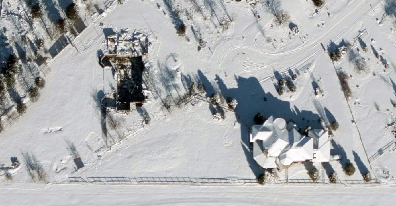
A First: A Post-Cat Collection with Snow
After the snowstorm moved away from the area and it was safe to fly, the GIC activated two planes to collect high-resolution imagery over the impacted communities. This is our first disaster collection with snow on the ground. Ortho imagery at a 7.5cm resolution is now available in GIC platforms.
This highly detailed imagery helps insurers and the community understand the full scale of this disaster, to remotely guide claims and public safety decisions, and to begin the rebuilding process.


 GIC
GIC