Pairing GIC Imagery with Advanced Analytics
There are many advantages to having unlimited access to rich geospatial data. First, you can get a better understanding of what real ground truth is without even having to be on site. Second, you can easily define built and natural structures to get a better context of the area and make measurements for assessments. And third, but certainly not last, you can take this data and layer it with analytics to extract additional information with AI/ML capabilities.
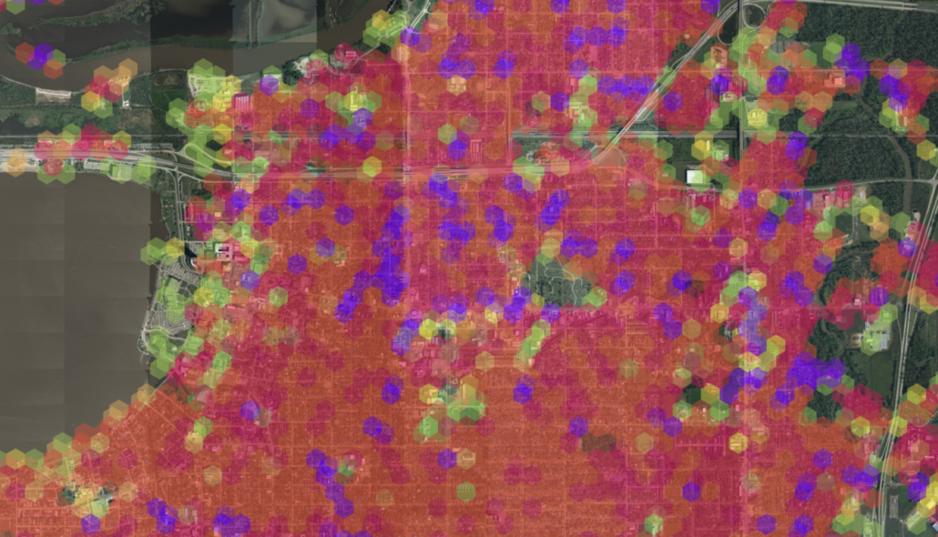
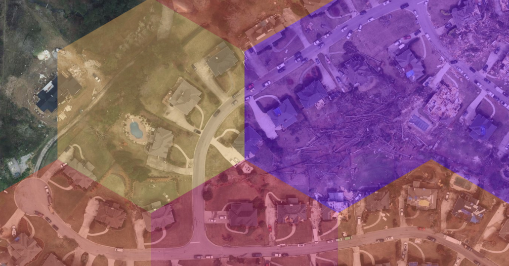
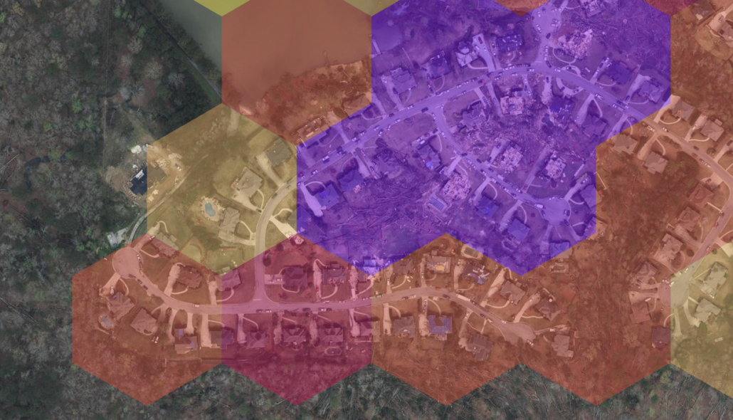
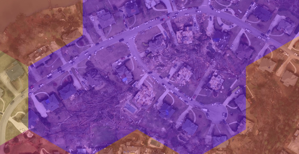
Munich Re, a partner of the GIC, provides an analytics solution process that uses the GIC’s advanced aerial imagery against machine learning models to quickly identify key attributes in a pre- and post-cat event such as a hurricane. These automated damage classification resources easily integrate into an insurer’s current workflows. The end result is improved situation awareness post-disaster.
“The collaboration with Munich Re is a true value-add to our member insurers, providing them an additional layer of critical insight when assessing damage after a major catastrophe,” says Ryan Bank, Managing Director for the GIC. “We first piloted Munich Re’s remote sensing technology during Hurricane Michael and quickly saw its potential for optimizing claims cycle time for our member insurers. In more than 40 percent of all property claims, its damage assessment was delivered before the insurer received the first notice of loss from the policyholder.”
Register for June 23, 2021 Webinar with Munich Re & GIC
Learn more about how to pair GIC imagery with the Munich Re platform at an upcoming webinar on June 23, 2021 at either 13:00 CEST or 11:00 a.m. MDT. Register here for more information!