New imagery online for northwestern Florida coast
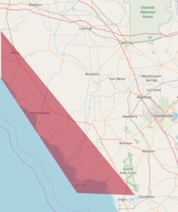
New imagery for the northwestern Florida coast from Ezell airport down to Waccasassa Bay Preserve is now online. This is captured with our wide-area Condor camera at 20cm. The coverage area is highlighted in the image below. here is the direct link to view it:
https://maps.geointel.org/app/nicb/?extent=-9414605.9229%2C3372679.4999%2C-9121087.7343%2C3546803.0503%2C102100