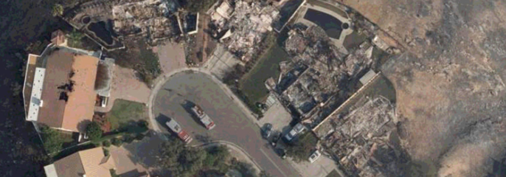
Hi Res Aerial Imagery of Southern California fires is Online
Imagery for a large area covering 600 square kilometers of the Thousand Oaks fires in Southern California is now online. GIC members can access the imagery online here:
https://maps.geointel.org/app/nicb/?extent=-13259002.1394%2C4037700.2673%2C-13199534.1314%2C4072708.4262%2C102100
Additionally, Imagery captured Sunday is being processed and should go live early Monday. stay tuned here for updates.


