Gray Sky Event: Hurricane Helene
Full Activation
Friday, September 27
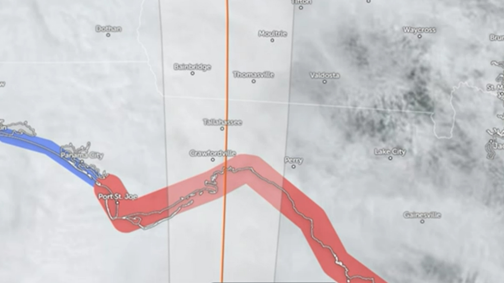
Hurricane Helene made landfall as a Category 4 hurricane overnight in Florida and is now moving inland. Our crews are fully activated, and aircraft are now collecting imagery of impacted areas. Today’s collection will depend on weather bands, residual cloud cover, and whether it is safe to fly. Currently, we have identified 23 areas of interest, focusing on regions with populations and buildings that were hardest hit by the hurricane’s winds.
Ready to Respond
Thursday, September 26
Our Gray Sky team has been meeting regularly this week to plan and prepare for Hurricane Helene. We have positioned several teams and aircraft equipped with Vexcel UltraCam sensors, ready to respond after the hurricane moves through Florida.
Our focus is on collecting high-resolution aerial imagery of impacted buildings and properties across multiple cities and areas.
We will continue to monitor the storm throughout the evening and adjust our collection plans based on Helene’s final path. Weather permitting, we plan to have our aircraft in the air and begin collecting imagery as early as Friday morning. Our current plan includes capturing orthos and multispectral imagery across all collection areas, as well as oblique imagery in more populated regions.
We will keep you updated as things progress tomorrow.
Request Access
Please let us know if you need imagery for your response and recovery. You can learn more about how the GIC captures Gray Sky events here. Please fill out our contact form below.


