GIC Collects Post-Disaster Imagery of Dallas Tornadoes
After tornadoes struck the Dallas-Fort Worth metro area on Sunday night, the Geospatial Intelligence Center (GIC) began flying aircraft over the impacted areas on Monday, collecting high-resolution aerial images of the damaged structures.
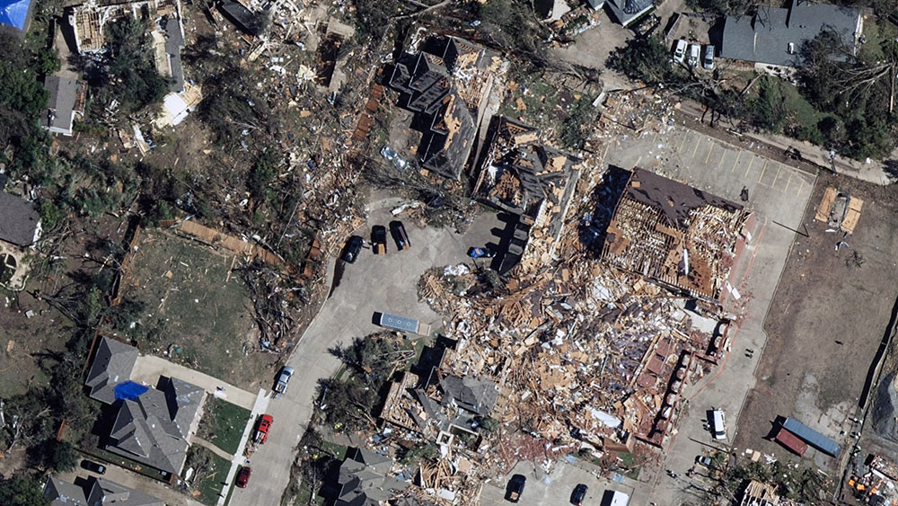
Imagery was made available to GIC members yesterday afternoon, giving insurers the ability to search an address and view before and after aerials images of properties within the impacted area. These images provide insurers with vital information to better respond and pay claims faster to victims while increasing fraud detection. The imagery is provided at no cost to emergency personnel, first responders, and law enforcement to assist in their response to the damage.
“Post-disaster damage assessment is what drives the recovery effort after tornadoes and other events like this strike. Affected areas need to be assessed to ascertain how many houses and businesses were destroyed,” said Richard Butgereit, director of catastrophe response, GIC. “It is our hope that by getting in quickly and assessing these efforts via high-resolution aerial imagery, we can help speed up the recovery process.”
In 2017, the NICB started searching for solutions to help our member companies and law enforcement advance technology post-disaster by developing the Geospatial Intelligence Center Program(GIC) that licenses high resolution aerial images from Vexcel Imaging US, Inc.
“Technological advances have improved in recent years, providing insurers with critical tools to enhance fraud detection and expedite fraud investigations. The GIC program is just another example of how the industry is leveraging innovation to help fight fraud in the wake of a disaster,” said NICB chief operating officer Jim Schweitzer.


 Geospatial Insurance Consortium
 Geospatial Insurance Consortium